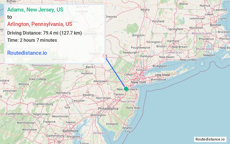
Distance from Adams, New Jersey to Arlington, Pennsylvania
The driving distance from Adams, New Jersey to Arlington, Pennsylvania is 122.5 mi (197.2 km)
The straight-line (air) distance is approximately 49.3 mi (79.4 km)
Estimated travel time by road is 2 hours 14 minutes
This route includes Toll roads along the way.
We found 3 routes between Adams and Arlington.
Available Routes
Route Directions
Get on I-287 N in Franklin Township from Bennetts Ln, John F Kennedy Blvd and Easton Ave
Continue on I-287 N. Take I-78 W, PA-33 N and I-80 W to PA-423 N in Tobyhanna. Take exit 8 from I-380 N
Follow PA-423 N/Church St and PA-196 N to PA-590 E in Salem Township
Route Directions
Get on I-287 N in Franklin Township from Bennetts Ln, John F Kennedy Blvd and Easton Ave
Continue on I-287 N. Take I-78 W, US-22 W, PA-33 N, I-80 W and I-380 N to PA-423 N in Tobyhanna. Take exit 8 from I-380 N
Follow PA-423 N/Church St and PA-196 N to PA-590 E in Salem Township
Route Directions
Get on I-287 N in Franklin Township from Bennetts Ln, John F Kennedy Blvd and Easton Ave
Follow I-287 N to US-202 N/US-206 N in Bedminster. Take exit 22B from I-287 N
Get on I-80 W in Mount Olive from US-206 N
Continue on I-80 W to Tobyhanna. Take exit 8 from I-380 N
Follow PA-423 N/Church St and PA-196 N to PA-590 E in Salem Township
Journey Details
Traveling from Adams, New Jersey to Arlington, Pennsylvania covers 113.3 miles (182 km) in a northwest direction. This mixed highways and local roads, substantial route typically takes 2 hours 15 minutes under normal conditions.
Drivers have 3 route options between these locations (113-123 miles / 182-197 km). The primary route shown here saves 5 minutes compared to alternatives.
The route features scenic views, toll sections. During midday weekday travel, expect lighter midday traffic with average speeds around 49 mph (79 km/h) .
Journey Waypoints
Adams
Starting Point
Arlington
Destination
Route Map Image