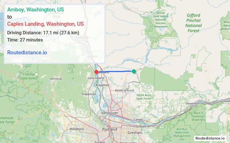
Distance from Amboy, Washington to Caples Landing, Washington
The driving distance from Amboy, Washington to Caples Landing, Washington is 25.5 mi (41 km)
The straight-line (air) distance is approximately 10.7 mi (17.1 km)
Estimated travel time by road is 37 minutes
We found 2 routes between Amboy and Caples Landing.
Available Routes
Route Directions
Follow NE 399th St and NE Grantham Rd to NE 379th St
Take NE 94th Ave, NE Lockwood Creek Rd, NW Lacenter Rd and I-5 N to Dike Access Rd in Woodland. Take exit 22 from I-5 N
Follow Dike Access Rd and Dike Rd to your destination
Route Directions
Follow NE Cedar Creek Rd and NE Hayes Rd to Goerig St in Woodland
Take Caples Rd to your destination
Journey Details
Traveling from Amboy, Washington to Caples Landing, Washington covers 20.3 miles (33 km) in a west direction. This mixed highways and local roads, moderate route typically takes 29 minutes under normal conditions.
Drivers have 2 route options between these locations (20-25 miles / 33-41 km). The primary route shown here saves 8 minutes compared to alternatives.
The route features scenic views. During evening weekday travel, expect evening rush hour with average speeds around 41 mph (66 km/h) .
Journey Waypoints
Amboy
Starting Point
Caples Landing
Destination
Route Map Image