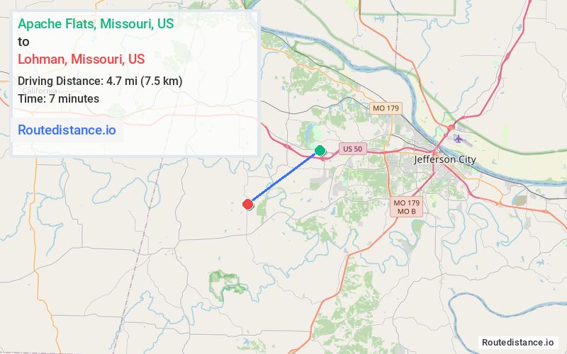
Distance from Apache Flats, Missouri to Lohman, Missouri
The driving distance from Apache Flats, Missouri to Lohman, Missouri is 7.5 mi (12.1 km)
The straight-line (air) distance is approximately 2.9 mi (4.7 km)
Estimated travel time by road is 11 minutes
We found 3 routes between Apache Flats and Lohman.
Available Routes
Route Directions
Route Directions
Take US-50 W, Lomo Dr and State Hwy D to High St in Lohman
Route Directions
Journey Details
Traveling from Apache Flats, Missouri to Lohman, Missouri covers 7 miles (11 km) in a southwest direction. This mixed highways and local roads, short route typically takes 9 minutes under normal conditions.
Drivers have 3 route options between these locations (7-8 miles / 11-13 km). The primary route shown here saves 2 minutes compared to alternatives.
The route features scenic views. During night weekday travel, expect minimal traffic congestion with average speeds around 43 mph (69 km/h) .
Journey Waypoints
Apache Flats
Starting Point
Lohman
Destination
Route Map Image