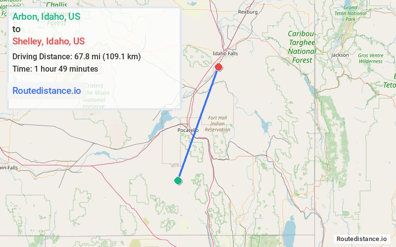
Distance from Arbon, Idaho to Shelley, Idaho
The driving distance from Arbon, Idaho to Shelley, Idaho is 81.4 mi (131 km)
The straight-line (air) distance is approximately 42.1 mi (67.8 km)
Estimated travel time by road is 1 hour 19 minutes
We found 2 routes between Arbon and Shelley.
Available Routes
Route Directions
Get on I-86 E/US-30 E in Arbon Valley
Take I-15 N to E 1250 N in Bingham County. Take exit 108 from I-15 N
Continue on E 1250 N. Take W Fir St to Center St/Taylor Rd in Shelley
Route Directions
Get on I-15 N in Pocatello from Arbon Valley Rd and Mink Creek Rd
Follow I-15 N to E 1250 N in Bingham County. Take exit 108 from I-15 N
Continue on E 1250 N. Take W Fir St to Center St/Taylor Rd in Shelley
Journey Details
Traveling from Arbon, Idaho to Shelley, Idaho covers 78.1 miles (126 km) in a northeast direction. This highway, substantial route typically takes 1 hour 25 minutes under normal conditions.
Drivers have 2 route options between these locations (78-81 miles / 126-131 km). The primary route shown here saves no time compared to alternatives.
The route features scenic views. During morning weekday travel, expect morning rush hour with average speeds around 57 mph (92 km/h) .
Journey Waypoints
Arbon
Starting Point
Shelley
Destination
Route Map Image