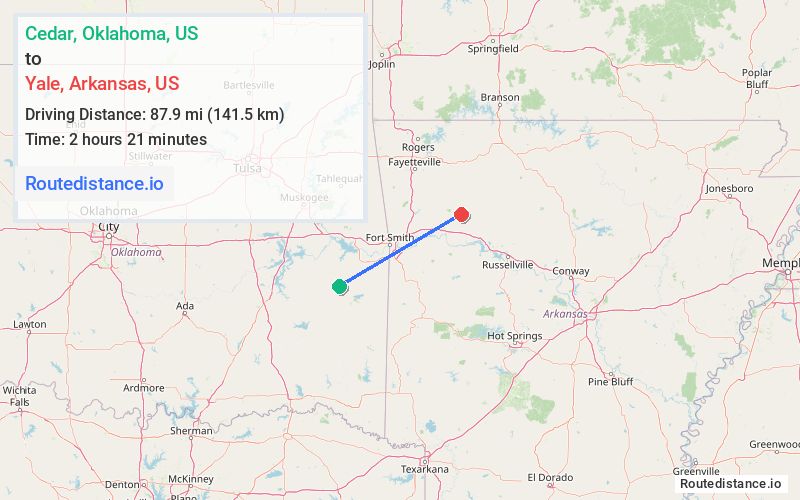
Distance from Cedar, Oklahoma to Yale, Arkansas
The driving distance from Cedar, Oklahoma to Yale, Arkansas is 125.5 mi (202 km)
The straight-line (air) distance is approximately 54.6 mi (87.9 km)
Estimated travel time by road is 2 hours 14 minutes
We found 3 routes between Cedar and Yale.
Available Routes
Route Directions
Take Cedar Rd and State Hwy 82 S to US-270 E in Red Oak
Continue on US-270 E to Poteau
Follow I-540 and I-40 E to AR-23 N/N 18th St in Ozark. Take exit 35 from I-40 E
Follow AR-23 N and AR-215 E to Forest Service Rd 1522 in Pettigrew
Route Directions
Take State Hwy 82 N, OK-31 E and Twilight Rd to US-59 N in Le Flore County
Take I-40 E to AR-23 N/N 18th St in Ozark. Take exit 35 from I-40 E
Follow AR-23 N and AR-215 E to Forest Service Rd 1522 in Pettigrew
Route Directions
Follow Cedar Rd and D1378 Rd to State Hwy 82 N
Take OK-31 E, US-271 N, I-540, I-40 E and AR-23 N to Forest Service Rd 1522 in Pettigrew
Journey Details
Traveling from Cedar, Oklahoma to Yale, Arkansas covers 124.8 miles (201 km) in a northeast direction. This mixed highways and local roads, substantial route typically takes 2 hours 18 minutes under normal conditions.
Drivers have 3 route options between these locations (125-138 miles / 201-221 km). The primary route shown here saves 8 minutes compared to alternatives.
The route features scenic views. During night weekday travel, expect minimal traffic congestion with average speeds around 53 mph (85 km/h) .
Journey Waypoints
Cedar
Starting Point
Yale
Destination
Route Map Image