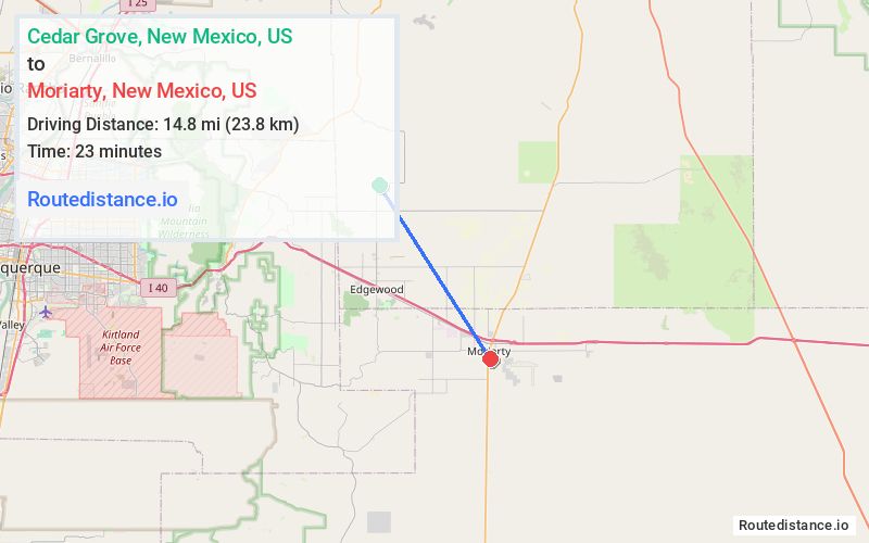
Distance from Cedar Grove, New Mexico to Moriarty, New Mexico
The driving distance from Cedar Grove, New Mexico to Moriarty, New Mexico is 18 mi (29 km)
The straight-line (air) distance is approximately 9.2 mi (14.8 km)
Estimated travel time by road is 21 minutes
We found 3 routes between Cedar Grove and Moriarty.
Available Routes
Route Directions
Follow NM-344 S and I-40 E to Center Ave in Moriarty
Continue on Center Ave. Drive to 4th St
Route Directions
Continue on NM-344 S. Take NM-333 E/U.S. Rte 66 and Martinez Rd to Center Ave in Moriarty
Continue on Center Ave. Drive to 4th St
Route Directions
Journey Details
Traveling from Cedar Grove, New Mexico to Moriarty, New Mexico covers 17.9 miles (29 km) in a southeast direction. This mixed highways and local roads, moderate route typically takes 25 minutes under normal conditions.
Drivers have 3 route options between these locations (18-19 miles / 29-31 km). The primary route shown here saves 2 minutes compared to alternatives.
The route features scenic views. During night weekend travel, expect typical weekend traffic patterns with average speeds around 41 mph (66 km/h) .
Journey Waypoints
Cedar Grove
Starting Point
Moriarty
Destination
Route Map Image