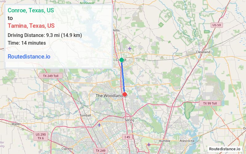
Distance from Conroe, Texas to Tamina, Texas
The driving distance from Conroe, Texas to Tamina, Texas is 10 mi (16.2 km)
The straight-line (air) distance is approximately 5.7 mi (9.3 km)
Estimated travel time by road is 18 minutes
We found 2 routes between Conroe and Tamina.
Available Routes
Route Directions
Take N Main St to TX-75 S/S Frazier St
Continue on TX-75 S/S Frazier St. Take N Fwy Service Rd, I-45 S and N Fwy Service Rd to Tamina Rd in Shenandoah
Route Directions
Get on I-45 S from N Main St and TX-75 S/S Frazier St
Follow I-45 S to N Fwy Service Rd. Take exit 77 from I-45 S
Follow N Fwy Service Rd to Tamina Rd
Journey Details
Traveling from Conroe, Texas to Tamina, Texas covers 10 miles (16 km) in a south direction. This secondary roads, short route typically takes 15 minutes under normal conditions.
Drivers have 2 route options between these locations (10-10 miles / 16-16 km). The primary route shown here saves 3 minutes compared to alternatives.
The route features scenic views. During midday weekday travel, expect lighter midday traffic with average speeds around 40 mph (64 km/h) .
Journey Waypoints
Conroe
Starting Point
Tamina
Destination
Route Map Image