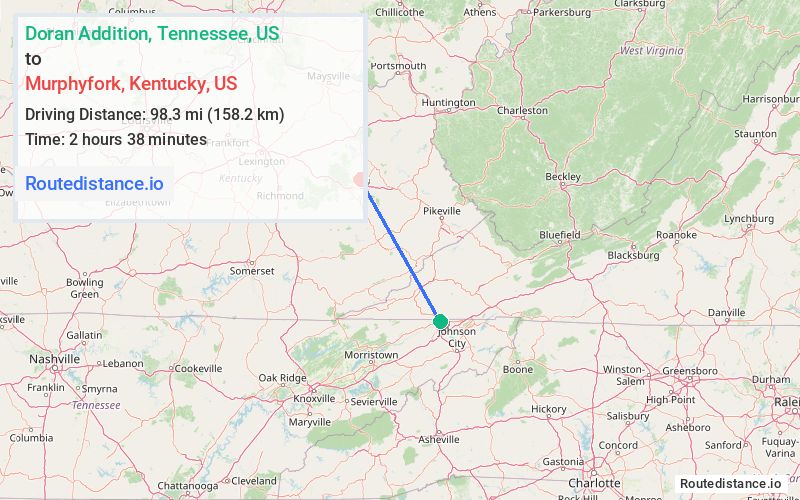
Distance from Doran Addition, Tennessee to Murphyfork, Kentucky
The driving distance from Doran Addition, Tennessee to Murphyfork, Kentucky is 166.3 mi (267.7 km)
The straight-line (air) distance is approximately 61.1 mi (98.3 km)
Estimated travel time by road is 3 hours 13 minutes
We found 3 routes between Doran Addition and Murphyfork.
Available Routes
Route Directions
Follow Skelton Bluff Rd, E Carters Valley Rd and VA-224 N to US-421 N/US-58 W in Scott County
Take US-23 N to KY-15 N in Whitesburg
Continue to Hazard
Follow KY-15 N to KY-1812/KY-205 N in Breathitt County. Take the KY-205 E exit from KY-15
Continue on KY-205 N. Take KY-191 to Murphy Fork Rd in Morgan County
Route Directions
Follow Skelton Bluff Rd, E Carters Valley Rd and VA-224 N to US-421 N/US-58 W in Scott County
Follow US-58 W and US-25E N to KY-1304 in Knox County
Take KY-11 N to US-421 N in Clay County
Continue on US-421 N. Take KY-30, KY-11 N, KY-715 N and Bert T Combs Mountain Pkwy E to KY-191 in Wolfe County. Exit from Bert T Combs Mountain Pkwy E
Continue on KY-191. Drive to Murphy Fork Rd in Morgan County
Route Directions
Follow Skelton Bluff Rd, E Carters Valley Rd and VA-224 N to US-421 N/US-58 W in Scott County
Get on KY-114 W in Prestonsburg from US-23 N
Follow KY-9009 W/Bert T Combs Mountain Pkwy W to KY-205 N in Insko. Exit from KY-9009 W/Bert T Combs Mountain Pkwy W
Take KY-191 and KY-1010 to Murphy Fork Rd in Morgan County
Journey Details
Traveling from Doran Addition, Tennessee to Murphyfork, Kentucky covers 164.3 miles (264 km) in a northwest direction. This mixed highways and local roads, substantial route typically takes 3 hours 4 minutes under normal conditions.
Drivers have 3 route options between these locations (164-201 miles / 264-323 km). The primary route shown here saves 57 minutes compared to alternatives.
The route features scenic views. During midday weekday travel, expect lighter midday traffic with average speeds around 54 mph (87 km/h) .
Journey Waypoints
Doran Addition
Starting Point
Murphyfork
Destination
Route Map Image