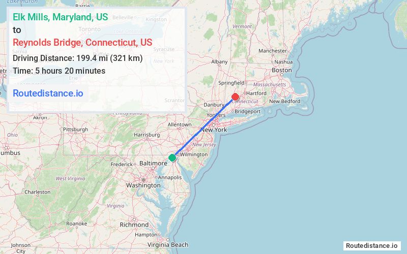
Distance from Elk Mills, Maryland to Reynolds Bridge, Connecticut
The driving distance from Elk Mills, Maryland to Reynolds Bridge, Connecticut is 262.9 mi (423.1 km)
The straight-line (air) distance is approximately 123.9 mi (199.5 km)
Estimated travel time by road is 4 hours 10 minutes
This route includes Toll roads along the way.
We found 3 routes between Elk Mills and Reynolds Bridge.
Available Routes
Route Directions
Get on I-95 N
Continue on I-95 N. Take NJ Tpke, I-95 N, I-287 N and I-87 S to Saw Mill Pkwy N/Saw Mill Riv Pkwy N in Greenburgh. Take exit 8A from I-87 S
Get on I-684 N in Bedford
Continue on I-684 N. Take I-84 E to Waterbury Rd in Thomaston. Take exit 38 from CT-8 N
Route Directions
Get on I-95 N
Continue on I-95 N. Take I-476 N, US-22 E and PA-33 N to PA-447 N/US-209 N in Smithfield Township. Take exit 309 from I-80 E
Get on I-84 E in Westfall Township from US-209 N
Follow I-84 E to Waterbury Rd in Thomaston. Take exit 38 from CT-8 N
Route Directions
Get on I-95 N
Continue on I-95 N. Take NJ Tpke, I-95 N, Hutchinson Riv Pkwy N, I-684 N and I-84 E to Waterbury Rd in Thomaston. Take exit 38 from CT-8 N
Journey Details
Traveling from Elk Mills, Maryland to Reynolds Bridge, Connecticut covers 236.3 miles (380 km) in a northeast direction. This highway, long-distance route typically takes 3 hours 44 minutes under normal conditions.
Drivers have 3 route options between these locations (236-288 miles / 380-463 km). The primary route shown here saves 1 hour and 9 minutes compared to alternatives.
The route features scenic views, toll sections. During morning weekday travel, expect morning rush hour with average speeds around 65 mph (105 km/h) .
Journey Waypoints
Elk Mills
Starting Point
Reynolds Bridge
Destination
Route Map Image