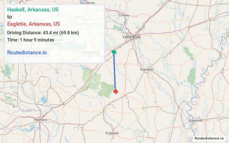
Distance from Haskell, Arkansas to Eagletie, Arkansas
The driving distance from Haskell, Arkansas to Eagletie, Arkansas is 57.6 mi (92.6 km)
The straight-line (air) distance is approximately 27 mi (43.4 km)
Estimated travel time by road is 1 hour 11 minutes
We found 2 routes between Haskell and Eagletie.
Available Routes
Route Directions
Take US-67 S, I-30 W and AR-9 to Eagle Tram Rd in Dallas County
Follow Eagle Tram Rd to Dallas 124
Route Directions
Take AR-229 S and AR-9 to Eagle Tram Rd in Dallas County
Follow Eagle Tram Rd to Dallas 124
Journey Details
Traveling from Haskell, Arkansas to Eagletie, Arkansas covers 52.3 miles (84 km) in a south direction. This mixed highways and local roads, moderate route typically takes 1 hour 10 minutes under normal conditions.
Drivers have 2 route options between these locations (52-58 miles / 84-93 km). The primary route shown here saves 47 seconds compared to alternatives.
The route features scenic views. During night weekday travel, expect minimal traffic congestion with average speeds around 43 mph (69 km/h) .
Journey Waypoints
Haskell
Starting Point
Eagletie
Destination
Route Map Image