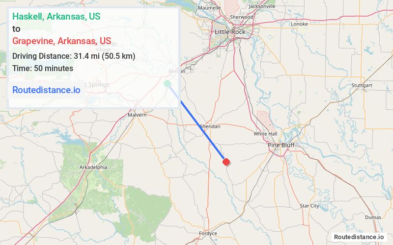
Distance from Haskell, Arkansas to Grapevine, Arkansas
The driving distance from Haskell, Arkansas to Grapevine, Arkansas is 52.6 mi (84.7 km)
The straight-line (air) distance is approximately 19.5 mi (31.4 km)
Estimated travel time by road is 59 minutes
We found 2 routes between Haskell and Grapevine.
Available Routes
Route Directions
Route Directions
Continue on Grand Ave to AR-35 S
Continue on AR-35 S to Grapevine
Journey Details
Traveling from Haskell, Arkansas to Grapevine, Arkansas covers 38.8 miles (62 km) in a southeast direction. This mixed highways and local roads, moderate route typically takes 50 minutes under normal conditions.
Drivers have 2 route options between these locations (39-53 miles / 62-85 km). The primary route shown here saves 10 minutes compared to alternatives.
The route features scenic views. During midday weekend travel, expect typical weekend traffic patterns with average speeds around 45 mph (72 km/h) .
Journey Waypoints
Haskell
Starting Point
Grapevine
Destination
Route Map Image