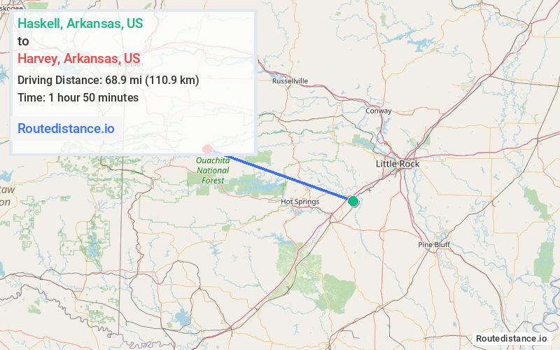
Distance from Haskell, Arkansas to Harvey, Arkansas
The driving distance from Haskell, Arkansas to Harvey, Arkansas is 108 mi (173.8 km)
The straight-line (air) distance is approximately 42.8 mi (68.9 km)
Estimated travel time by road is 2 hours 8 minutes
We found 3 routes between Haskell and Harvey.
Available Routes
Route Directions
Take US-70 W, AR 7 N and AR-60 W to AR-28 W in Harvey
Route Directions
Take AR-5, AR-9 N and AR-60 W to AR-28 W in Harvey
Route Directions
Follow I-30 W and US-270 W to Montgomery County
Follow NF-33 and Forester Rd/Winding Bend Rd to AR-28 E in Harvey
Journey Details
Traveling from Haskell, Arkansas to Harvey, Arkansas covers 99.6 miles (160 km) in a west direction. This mixed highways and local roads, substantial route typically takes 2 hours 8 minutes under normal conditions.
Drivers have 3 route options between these locations (100-111 miles / 160-179 km). The primary route shown here saves 5 minutes compared to alternatives.
Journey Waypoints
Haskell
Starting Point
Harvey
Destination
Route Map Image