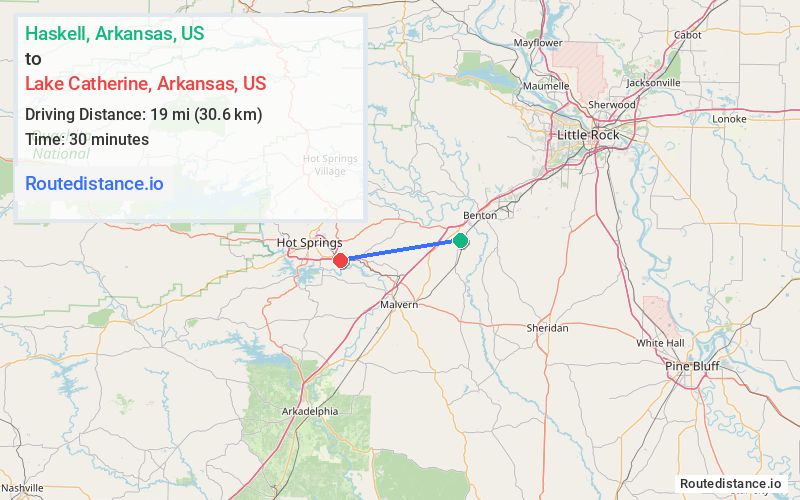
Distance from Haskell, Arkansas to Lake Catherine, Arkansas
The driving distance from Haskell, Arkansas to Lake Catherine, Arkansas is 27 mi (43.4 km)
The straight-line (air) distance is approximately 11.8 mi (19 km)
Estimated travel time by road is 30 minutes
We found 3 routes between Haskell and Lake Catherine.
Available Routes
Route Directions
Follow US-67 S, I-30 W and US-270 W to Starr Dr in Garland County
Route Directions
Follow Crossroads to US-70 W
Continue on US-70 W to Garland County
Route Directions
Drive along US-67 S
Take Military Rd to AR-51 S in Hot Spring County
Continue on AR-51 S to Garland County
Journey Details
Traveling from Haskell, Arkansas to Lake Catherine, Arkansas covers 25.1 miles (40 km) in a west direction. This mixed highways and local roads, moderate route typically takes 35 minutes under normal conditions.
Drivers have 3 route options between these locations (25-27 miles / 40-44 km). The primary route shown here saves no time compared to alternatives.
The route features scenic views. During midday weekend travel, expect typical weekend traffic patterns with average speeds around 41 mph (66 km/h) .
Journey Waypoints
Haskell
Starting Point
Lake Catherine
Destination
Route Map Image