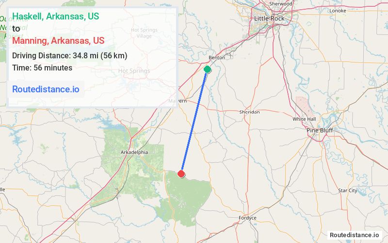
Distance from Haskell, Arkansas to Manning, Arkansas
The driving distance from Haskell, Arkansas to Manning, Arkansas is 60.1 mi (96.8 km)
The straight-line (air) distance is approximately 21.6 mi (34.8 km)
Estimated travel time by road is 1 hour 6 minutes
We found 3 routes between Haskell and Manning.
Available Routes
Route Directions
Continue on US-67 S. Take I-30 W to AR 7 S/AR-8 E/Caddo St in Arkadelphia
Follow AR-8 E to Dallas 334 in Dallas County
Route Directions
Drive from AR-229 S, AR-9 and AR-8 W to Dallas County
Drive to Dallas 334
Route Directions
Take AR-51 S, State Hwy 128 and AR-8 E to Dallas 334 in Dallas County
Journey Details
Traveling from Haskell, Arkansas to Manning, Arkansas covers 53 miles (85 km) in a south direction. This mixed highways and local roads, moderate route typically takes 1 hour 8 minutes under normal conditions.
Drivers have 3 route options between these locations (53-60 miles / 85-97 km). The primary route shown here saves 2 minutes compared to alternatives.
The route features scenic views. During night weekday travel, expect minimal traffic congestion with average speeds around 46 mph (74 km/h) .
Journey Waypoints
Haskell
Starting Point
Manning
Destination
Route Map Image