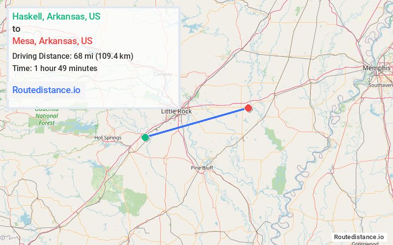
Distance from Haskell, Arkansas to Mesa, Arkansas
The driving distance from Haskell, Arkansas to Mesa, Arkansas is 78.6 mi (126.6 km)
The straight-line (air) distance is approximately 42.2 mi (68 km)
Estimated travel time by road is 1 hour 14 minutes
We found 3 routes between Haskell and Mesa.
Available Routes
Route Directions
Get on I-30 E in Benton
Follow I-30 E and I-40 E to AR-11 S/US-63 S in Hazen. Take exit 193 from I-40 E
Drive to US-70 E
Route Directions
Get on I-30 E in Benton
Follow I-30 E to AR-35 S/W Carpenter St. Take exit 117 from I-30 E
Get on I-530 N/US-167 N/US-65 N from Edison Ave, AR-183 N and W Sardis Rd
Follow I-530 N/US-167 N/US-65 N, I-440 E and I-40 E to AR-11 S/US-63 S in Hazen. Take exit 193 from I-40 E
Drive to US-70 E
Route Directions
Get on I-30 E in Benton
Continue on I-30 E. Take I-40 E to AR-11 S/US-63 S in Hazen. Take exit 193 from I-40 E
Drive to US-70 E
Journey Details
Traveling from Haskell, Arkansas to Mesa, Arkansas covers 78 miles (126 km) in a east direction. This highway, substantial route typically takes 1 hour 13 minutes under normal conditions.
Drivers have 3 route options between these locations (78-89 miles / 126-144 km). The primary route shown here saves 24 minutes compared to alternatives.
Journey Waypoints
Haskell
Starting Point
Mesa
Destination
Route Map Image