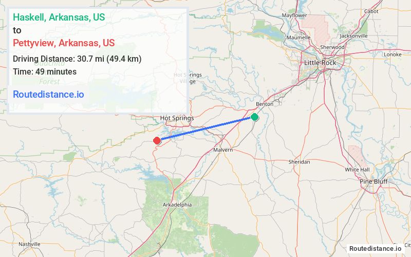
Distance from Haskell, Arkansas to Pettyview, Arkansas
The driving distance from Haskell, Arkansas to Pettyview, Arkansas is 39.4 mi (63.4 km)
The straight-line (air) distance is approximately 19.1 mi (30.7 km)
Estimated travel time by road is 49 minutes
We found 3 routes between Haskell and Pettyview.
Available Routes
Route Directions
Take US-67 S, I-30 W, AR-171 N and State Hwy 290 to Albright Rd in Lake Hamilton
Continue on Albright Rd. Drive to Amity Rd
Route Directions
Continue on US-67 S. Take I-30 W, US-270 W and US-70 W to AR-88/State Hwy 88/Higdon Ferry Rd in Hot Springs. Take exit 4 from US-270 W/US-70 W
Drive to Amity Rd
Route Directions
Follow Crossroads to US-70 W
Follow US-70 W to AR-88/State Hwy 88/Higdon Ferry Rd in Hot Springs. Take exit 4 from US-70 W
Drive to Amity Rd
Journey Details
Traveling from Haskell, Arkansas to Pettyview, Arkansas covers 39.3 miles (63 km) in a west direction. This mixed highways and local roads, moderate route typically takes 46 minutes under normal conditions.
Drivers have 3 route options between these locations (39-41 miles / 63-67 km). The primary route shown here saves 4 minutes compared to alternatives.
Journey Waypoints
Haskell
Starting Point
Pettyview
Destination
Route Map Image