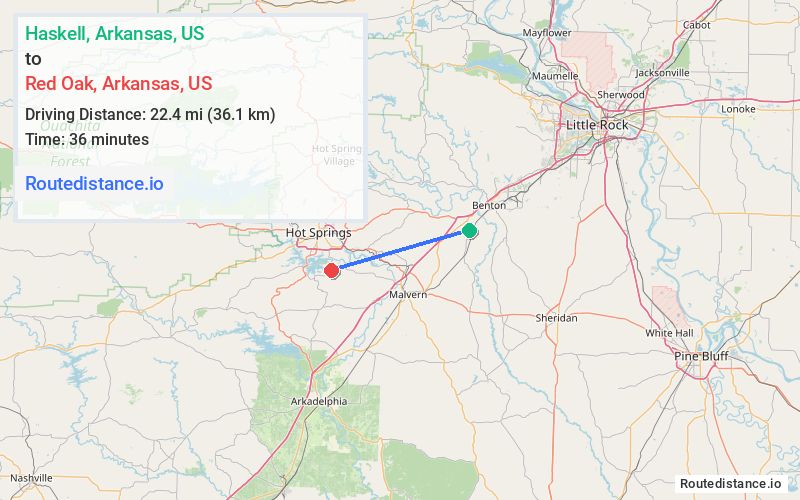
Distance from Haskell, Arkansas to Red Oak, Arkansas
The driving distance from Haskell, Arkansas to Red Oak, Arkansas is 32 mi (51.5 km)
The straight-line (air) distance is approximately 13.9 mi (22.4 km)
Estimated travel time by road is 37 minutes
We found 3 routes between Haskell and Red Oak.
Available Routes
Route Directions
Follow Crossroads to US-70 W
Continue on US-70 W to Hot Springs. Take exit 7 from US-70 W
Drive to AR-128 W/State Hwy 290
Route Directions
Follow US-67 S, I-30 W and US-270 W to AR-128 W/Carpenter Dam Rd in Hot Springs. Take exit 7 from US-270 W/US-70 W
Drive to AR-128 W/State Hwy 290
Route Directions
Follow US-67 S and I-30 W to AR-84 W in Malvern. Take exit 97 from I-30 W
Follow AR-171 N to State Hwy 290 in Garland County
Journey Details
Traveling from Haskell, Arkansas to Red Oak, Arkansas covers 28.7 miles (46 km) in a west direction. This mixed highways and local roads, moderate route typically takes 33 minutes under normal conditions.
Drivers have 3 route options between these locations (29-34 miles / 46-55 km). The primary route shown here saves 8 minutes compared to alternatives.
The route features scenic views. During midday weekend travel, expect typical weekend traffic patterns with average speeds around 55 mph (89 km/h) .
Journey Waypoints
Haskell
Starting Point
Red Oak
Destination
Route Map Image