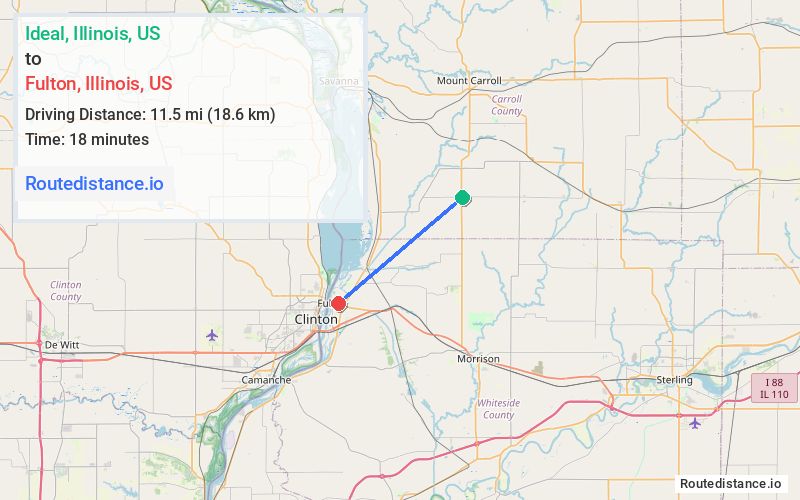
Distance from Ideal, Illinois to Fulton, Illinois
The driving distance from Ideal, Illinois to Fulton, Illinois is 15 mi (24.2 km)
The straight-line (air) distance is approximately 7.2 mi (11.5 km)
Estimated travel time by road is 20 minutes
We found 3 routes between Ideal and Fulton.
Available Routes
Route Directions
Take Spring Valley Rd and Penrose Rd to IL-84 S/Waller Rd in Fulton Township
Follow 10th Ave to 9th St
Route Directions
Take Nelson Rd, Union Grove Rd and Penrose Rd to IL-84 S/Waller Rd in Fulton Township
Follow 10th Ave to 9th St
Route Directions
Journey Details
Traveling from Ideal, Illinois to Fulton, Illinois covers 14.2 miles (23 km) in a southwest direction. This mixed highways and local roads, moderate route typically takes 17 minutes under normal conditions.
Drivers have 3 route options between these locations (14-17 miles / 23-27 km). The primary route shown here saves 4 minutes compared to alternatives.
The route features scenic views. During evening weekday travel, expect evening rush hour with average speeds around 50 mph (80 km/h) .
Journey Waypoints
Ideal
Starting Point
Fulton
Destination
Route Map Image