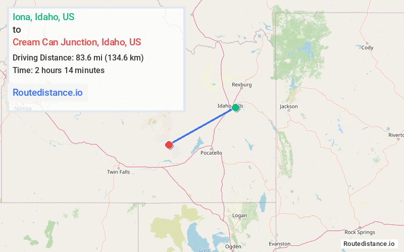
Distance from Iona, Idaho to Cream Can Junction, Idaho
The driving distance from Iona, Idaho to Cream Can Junction, Idaho is 156.6 mi (252 km)
The straight-line (air) distance is approximately 52 mi (83.6 km)
Estimated travel time by road is 2 hours 45 minutes
We found 3 routes between Iona and Cream Can Junction.
Available Routes
Route Directions
Get on I-15 S in Idaho Falls from E 49th N and US-20 W
Follow I-15 S and I-86 W to ID-25 W in Cassia County. Take exit 216 from I-84 W
Continue on ID-25 W. Take ID-24 W, Arco Minidoka Desert Rd and Haystack Rd to Minidoka to Arco Rd in Blaine County
Route Directions
Get on I-15 S/US-20 W in Idaho Falls from E Iona Rd
Follow I-15 S and I-86 W to ID-25 W in Cassia County. Take exit 216 from I-84 W
Continue on ID-25 W. Take ID-24 W, Arco Minidoka Desert Rd and Haystack Rd to Minidoka to Arco Rd in Blaine County
Route Directions
Follow E Iona Rd to US-20 BUS
Follow US-20 W and US-26 E to N 1400 W/Willow Rd in Bingham County
Follow N 1400 W/Willow Rd to ID-39 S/W State Hwy 39 in Pingree
Continue on W 2000 S. Take Funk Rd, Ice Caves Rd and Ice Cave B to Minidoka to Arco Rd in Blaine County
Journey Details
Traveling from Iona, Idaho to Cream Can Junction, Idaho covers 141.6 miles (228 km) in a west direction. This mixed highways and local roads, substantial route typically takes 3 hours 27 minutes under normal conditions.
Drivers have 3 route options between these locations (142-157 miles / 228-252 km). The primary route shown here saves no time compared to alternatives.
The route features scenic views. During midday weekday travel, expect lighter midday traffic with average speeds around 44 mph (71 km/h) .
Journey Waypoints
Iona
Starting Point
Cream Can Junction
Destination
Route Map Image