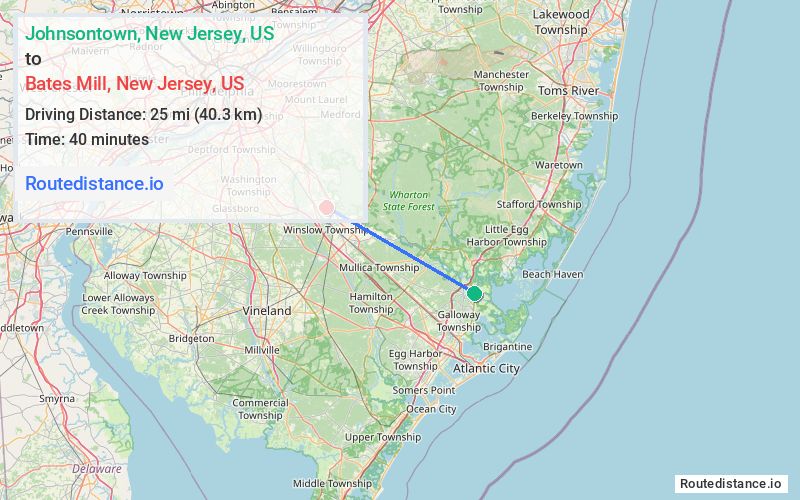
Distance from Johnsontown, New Jersey to Bates Mill, New Jersey
The driving distance from Johnsontown, New Jersey to Bates Mill, New Jersey is 30.2 mi (48.6 km)
The straight-line (air) distance is approximately 15.5 mi (25 km)
Estimated travel time by road is 41 minutes
We found 3 routes between Johnsontown and Bates Mill.
Available Routes
Route Directions
Take Chestnut Neck Rd, Atlantic County Rd 624 W, Pleasant Mills Rd, Nesco Rd and US-30 W/S White Horse Pike to Ehrke Rd in Winslow Township
Route Directions
Get on Atlantic City Expy W in Hamilton from Riverside Dr, S Pomona Rd and Wrangleboro Rd
Follow Atlantic City Expy W to NJ-73 N in Winslow Township. Take exit 31 from Atlantic City Expy W
Follow NJ-73 N and Waterford-Blue Anchor Rd to Ehrke Rd
Route Directions
Follow US-9 N/New York Rd and Chestnut Neck Rd to Cologne Port Republic Rd in Port Republic
Continue on Cologne Port Republic Rd to Galloway
Continue on W Moss Mill Rd to Winslow Township
Journey Details
Traveling from Johnsontown, New Jersey to Bates Mill, New Jersey covers 28.7 miles (46 km) in a northwest direction. This mixed highways and local roads, moderate route typically takes 39 minutes under normal conditions.
Drivers have 3 route options between these locations (29-35 miles / 46-56 km). The primary route shown here saves 2 minutes compared to alternatives.
Journey Waypoints
Johnsontown
Starting Point
Bates Mill
Destination
Route Map Image