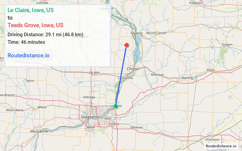
Distance from Le Claire, Iowa to Teeds Grove, Iowa
The driving distance from Le Claire, Iowa to Teeds Grove, Iowa is 34.7 mi (55.8 km)
The straight-line (air) distance is approximately 18.1 mi (29.1 km)
Estimated travel time by road is 43 minutes
We found 3 routes between Le Claire and Teeds Grove.
Available Routes
Route Directions
Take US-67 N and 380th Ave to 150th St in Clinton County
Take 390th Ave to 140th St
Continue on 140th St. Drive to 432nd Ave in Teeds Grove
Route Directions
Take IL-84 N to Ward Rd in Garden Plain Township
Take Co Hwy 36 to IL-136 W/14th Ave in Fulton
Continue on IL-136 W to Clinton
Take 442nd Ave to 432nd Ave in Teeds Grove
Route Directions
Take Mill Creek Pkwy and 442nd Ave to 432nd Ave in Teeds Grove
Journey Details
Traveling from Le Claire, Iowa to Teeds Grove, Iowa covers 34.2 miles (55 km) in a north direction. This mixed highways and local roads, moderate route typically takes 43 minutes under normal conditions.
Drivers have 3 route options between these locations (34-43 miles / 55-69 km). The primary route shown here saves 14 minutes compared to alternatives.
The route features scenic views. During night weekday travel, expect minimal traffic congestion with average speeds around 46 mph (74 km/h) .
Journey Waypoints
Le Claire
Starting Point
Teeds Grove
Destination
Route Map Image