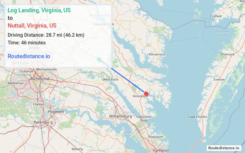
Distance from Log Landing, Virginia to Nuttall, Virginia
The driving distance from Log Landing, Virginia to Nuttall, Virginia is 41.1 mi (66.1 km)
The straight-line (air) distance is approximately 17.8 mi (28.7 km)
Estimated travel time by road is 52 minutes
We found 3 routes between Log Landing and Nuttall.
Available Routes
Route Directions
Take Newington Ln and State Rte 631 to VA-14 E
Continue on VA-14 E. Take State Rte 603, US-17 S and VA-198 E to VA-14 W/VA-3 E in Gloucester County
Route Directions
Follow VA-14 E and State Rte 603 to US-17 S in Middlesex County
Take VA-33 E to VA-14 W/VA-3 E in Gloucester County
Route Directions
Take Newington Ln and State Rte 631 to VA-14 E
Continue on VA-14 E. Take US-17 S to VA-14 E/VA-3 W in Gloucester County
Journey Details
Traveling from Log Landing, Virginia to Nuttall, Virginia covers 35.2 miles (57 km) in a southeast direction. This mixed highways and local roads, moderate route typically takes 44 minutes under normal conditions.
Drivers have 3 route options between these locations (35-45 miles / 57-73 km). The primary route shown here saves 13 minutes compared to alternatives.
The route features scenic views. During night weekday travel, expect minimal traffic congestion with average speeds around 48 mph (77 km/h) .
Journey Waypoints
Log Landing
Starting Point
Nuttall
Destination
Route Map Image