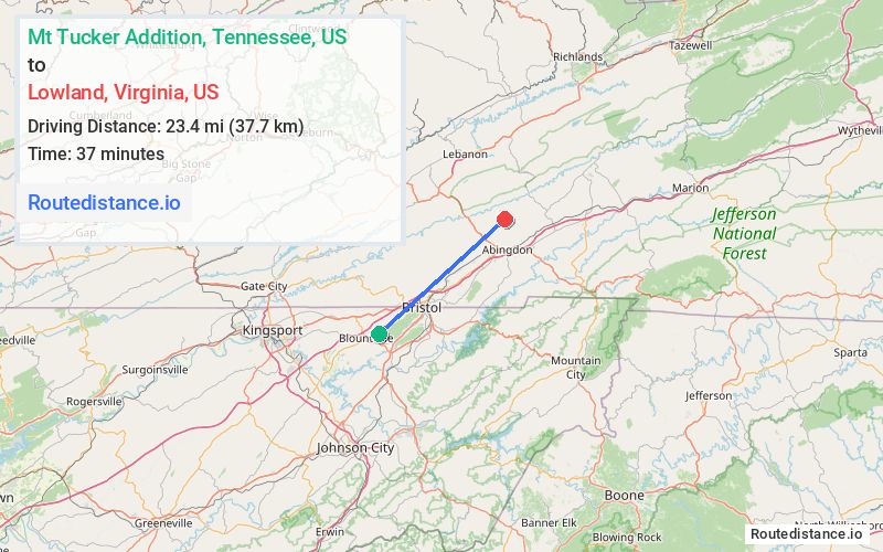
Distance from Mt Tucker Addition, Tennessee to Lowland, Virginia
The driving distance from Mt Tucker Addition, Tennessee to Lowland, Virginia is 29.5 mi (47.5 km)
The straight-line (air) distance is approximately 14.6 mi (23.4 km)
Estimated travel time by road is 38 minutes
We found 2 routes between Mt Tucker Addition and Lowland.
Available Routes
Route Directions
Get on I-81 N in Bristol from TN-126 E and Walnut Hill Rd
Follow I-81 N to VA-75 N/Cummings St in Abingdon. Take exit 17 from I-81 N
Take Whites Mill Rd to Toole Creek Rd
Route Directions
Follow Milden Hall Rd to TN-126 E
Continue on TN-126 E. Take I-81 N, Reedy Creek Rd, Black Hollow Rd and Rich Valley Rd to Toole Creek Rd in Washington County
Journey Details
Traveling from Mt Tucker Addition, Tennessee to Lowland, Virginia covers 28.3 miles (45 km) in a northeast direction. This mixed highways and local roads, moderate route typically takes 44 minutes under normal conditions.
Drivers have 2 route options between these locations (28-30 miles / 45-48 km). The primary route shown here saves no time compared to alternatives.
The route features scenic views. During evening weekday travel, expect evening rush hour with average speeds around 41 mph (66 km/h) .
Journey Waypoints
Mt Tucker Addition
Starting Point
Lowland
Destination
Route Map Image