Distance from Myrtle Beach, South Carolina to Socastee, South Carolina
The driving distance from Myrtle Beach, South Carolina to Socastee, South Carolina is 8.1 mi (13.1 km)
The straight-line (air) distance is approximately 4.3 mi (6.8 km)
Estimated travel time by road is 14 minutes
We found 2 routes between Myrtle Beach and Socastee.
Available Routes
Route Directions
Route Directions
Drive along US-501 N and US-17 S. Take the Farrow Pkwy SW exit from US-17 S
Follow SC-707 S/Socastee Blvd to River Rd in Socastee
Journey Details
Traveling from Myrtle Beach, South Carolina to Socastee, South Carolina covers 8.1 miles (13 km) in a west direction. This secondary roads, short route typically takes 14 minutes under normal conditions.
Drivers have 2 route options between these locations (8-8 miles / 13-13 km). The primary route shown here saves 18 seconds compared to alternatives.
The route features coastal roads. During evening weekend travel, expect typical weekend traffic patterns with average speeds around 33 mph (53 km/h) .
Journey Waypoints
Myrtle Beach
Starting Point
Socastee
Destination
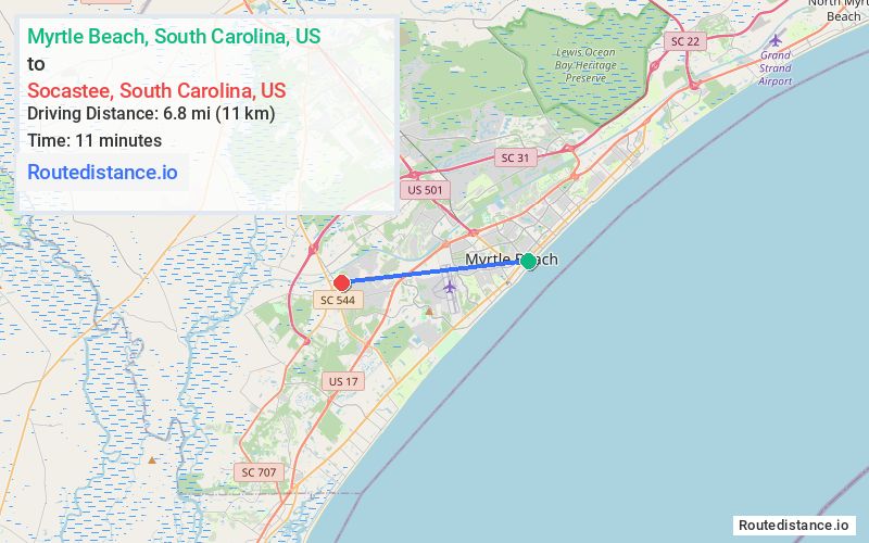
Route Map Image