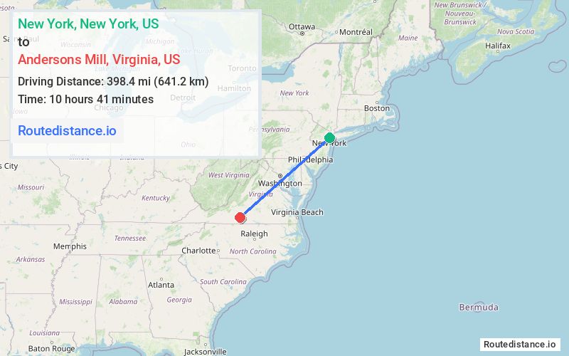
Distance from New York, New York to Andersons Mill, Virginia
The driving distance from New York, New York to Andersons Mill, Virginia is 458.8 mi (738.3 km)
The straight-line (air) distance is approximately 247.6 mi (398.4 km)
Estimated travel time by road is 7 hours 53 minutes
This route includes Toll roads along the way.
Route Directions
Get on I-478 from Broadway
Take I-278 W, I-95 S, NJ Tpke S, I-95 S, ... and I-66 W to US-29 S in Gainesville. Take exit 43A from I-66 W
Continue to Lynchburg. Take the US-29 S/US-460 W exit from US-29 S
Follow US-460 W to US-29 S in Campbell County. Take the US-29 S exit from US-29 S/US-460 W
Continue on US-29 S to your destination in Pittsylvania County
Journey Details
Traveling from New York, New York to Andersons Mill, Virginia covers 455.1 miles (732 km) in a southwest direction. This highway, long-distance route typically takes 7 hours 37 minutes under normal conditions.
The route features toll sections. During night weekday travel, expect minimal traffic congestion with average speeds around 61 mph (98 km/h) .
Journey Waypoints
New York
Starting Point
Andersons Mill
Destination
Route Map Image