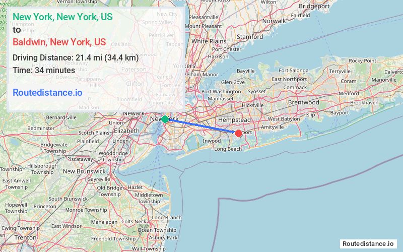
Distance from New York, New York to Baldwin, New York
The driving distance from New York, New York to Baldwin, New York is 31.5 mi (50.8 km)
The straight-line (air) distance is approximately 13.3 mi (21.4 km)
Estimated travel time by road is 51 minutes
We found 3 routes between New York and Baldwin.
Available Routes
Route Directions
Get on Brooklyn Brg from Park Row
Take I-278 E, I-495 E, Grand Central Pkwy, Cross Island Pkwy and Southern State Pkwy to Grand Ave in South Hempstead. Take exit 20 S from Southern State Pkwy
Continue on Grand Ave. Drive to Milburn Ave
Route Directions
Get on Brooklyn Brg from Park Row
Take I-278 E, I-495 E, Cross Island Pkwy and Southern State Pkwy to Grand Ave in South Hempstead. Take exit 20 S from Southern State Pkwy
Continue on Grand Ave. Drive to Milburn Ave
Route Directions
Get on Brooklyn Brg from Park Row
Take I-278 E, I-495 E, Grand Central Pkwy, I-678 S, ... and Southern State Pkwy to Grand Ave in South Hempstead. Take exit 20 S from Southern State Pkwy
Continue on Grand Ave. Drive to Milburn Ave
Journey Details
Traveling from New York, New York to Baldwin, New York covers 30.4 miles (49 km) in a east direction. This secondary roads, moderate route typically takes 53 minutes under normal conditions.
Drivers have 3 route options between these locations (30-32 miles / 49-51 km). The primary route shown here saves 4 minutes compared to alternatives.
The route features scenic views. During midday weekday travel, expect lighter midday traffic with average speeds around 33 mph (53 km/h) .
Journey Waypoints
New York
Starting Point
Baldwin
Destination
Route Map Image