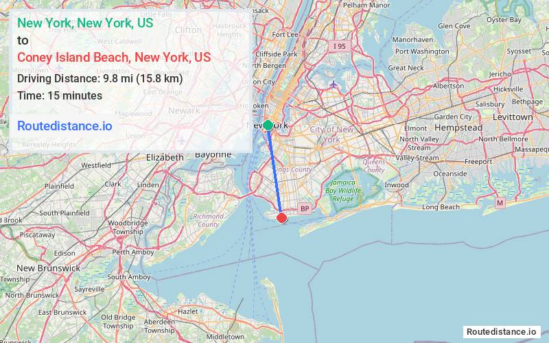
Distance from New York, New York to Coney Island Beach, New York
The driving distance from New York, New York to Coney Island Beach, New York is 13.6 mi (21.8 km)
The straight-line (air) distance is approximately 6.1 mi (9.8 km)
Estimated travel time by road is 26 minutes
This route includes Toll roads along the way.
We found 3 routes between New York and Coney Island Beach.
Available Routes
Route Directions
Get on I-478 from Murray St, West St and Exit 2
Continue on I-478. Take Belt Pkwy/Leif Ericson Dr to Shore Pkwy in Brooklyn. Take exit 6 from Belt Pkwy/Leif Ericson Dr/Shore Pkwy
Continue on Shore Pkwy. Take Cropsey Ave and W 17th St to Surf Ave
Route Directions
Get on Brooklyn Brg from Park Row
Take I-278 W and Belt Pkwy/Leif Ericson Dr to Shore Pkwy in Brooklyn. Take exit 6 from Belt Pkwy/Leif Ericson Dr/Shore Pkwy
Continue on Shore Pkwy. Take Cropsey Ave and W 17th St to Surf Ave
Route Directions
Take Murray St to Hudson River Greenway/West St
Take I-478, NY-27/Prospect Expy and Ocean Pkwy to Surf Ave in Brooklyn
Journey Details
Traveling from New York, New York to Coney Island Beach, New York covers 11.4 miles (18 km) in a south direction. This local streets, short route typically takes 38 minutes under normal conditions.
Drivers have 3 route options between these locations (11-14 miles / 18-22 km). The primary route shown here saves no time compared to alternatives.
The route features toll sections, coastal roads, urban congestion. During night weekday travel, expect minimal traffic congestion with average speeds around 20 mph (32 km/h) .
Journey Waypoints
New York
Starting Point
Coney Island Beach
Destination
Route Map Image