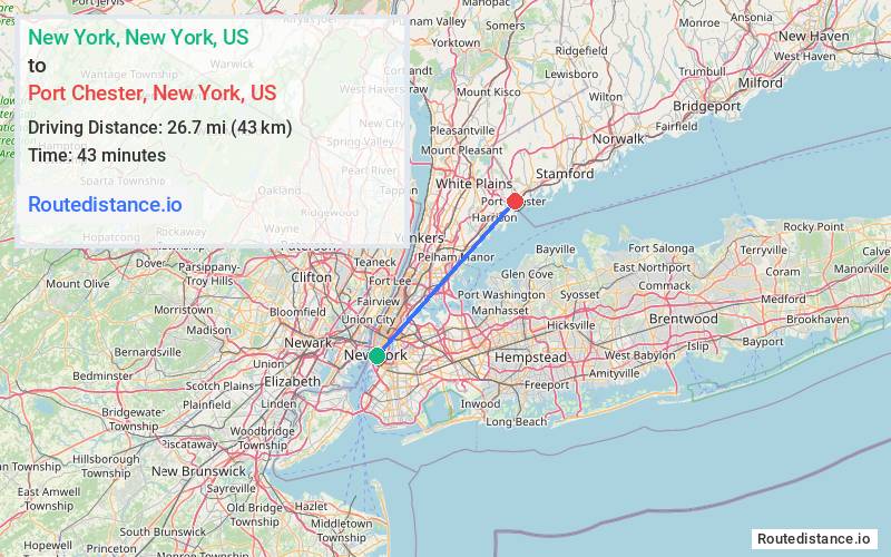
Distance from New York, New York to Port Chester, New York
The driving distance from New York, New York to Port Chester, New York is 32.4 mi (52.1 km)
The straight-line (air) distance is approximately 16.6 mi (26.7 km)
Estimated travel time by road is 47 minutes
This route includes Toll roads along the way.
We found 3 routes between New York and Port Chester.
Available Routes
Route Directions
Get on FDR Dr from Frankfort St
Follow FDR Dr, I-278 E/Bruckner Expy and I-95 N to US-1 N/Boston Post Rd in Port Chester. Take exit 21 from I-95 N
Continue on US-1 N/Boston Post Rd. Drive to Pearl St
Route Directions
Take Frankfort St and South St to FDR Dr
Continue on FDR Dr. Take I-87 N, Cross County Pkwy and Hutchinson Riv Pkwy N to Westchester Ave in Harrison. Take exit 15A from Hutchinson Riv Pkwy N
Follow Westchester Ave to N Pearl St in Port Chester
Route Directions
Get on FDR Dr from Frankfort St
Continue on FDR Dr. Take I-87 N, Cross County Pkwy and Hutchinson Riv Pkwy N to Westchester Ave in Harrison. Take exit 15A from Hutchinson Riv Pkwy N
Follow Westchester Ave to N Pearl St in Port Chester
Journey Details
Traveling from New York, New York to Port Chester, New York covers 32.4 miles (52 km) in a northeast direction. This mixed highways and local roads, moderate route typically takes 47 minutes under normal conditions.
Drivers have 3 route options between these locations (32-34 miles / 52-54 km). The primary route shown here saves 7 minutes compared to alternatives.
The route features scenic views, toll sections. During night weekday travel, expect minimal traffic congestion with average speeds around 44 mph (71 km/h) .
Journey Waypoints
New York
Starting Point
Port Chester
Destination
Route Map Image