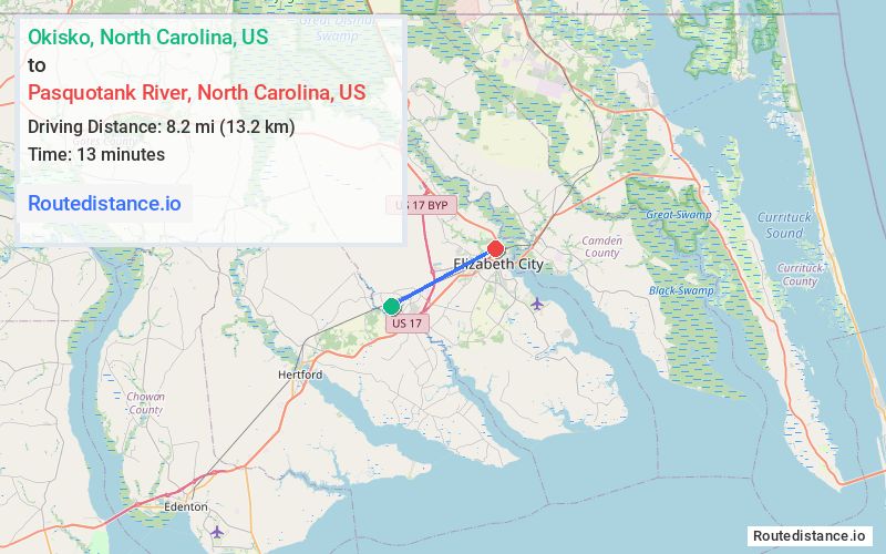
Distance from Okisko, North Carolina to Pasquotank River, North Carolina
The driving distance from Okisko, North Carolina to Pasquotank River, North Carolina is 11.9 mi (19.2 km)
The straight-line (air) distance is approximately 5.1 mi (8.2 km)
Estimated travel time by road is 16 minutes
We found 3 routes between Okisko and Pasquotank River.
Available Routes
Route Directions
Route Directions
Take Exit 255 and US-17 N to Simpson Ditch Rd
Continue on Body Rd. Take NC-344 S to River Rd in Elizabeth City
Route Directions
Take US-17 N and NC-344 S to River Rd in Elizabeth City
Journey Details
Traveling from Okisko, North Carolina to Pasquotank River, North Carolina covers 11.7 miles (19 km) in a northeast direction. This mixed highways and local roads, short route typically takes 17 minutes under normal conditions.
Drivers have 3 route options between these locations (12-12 miles / 19-19 km). The primary route shown here saves no time compared to alternatives.
The route features scenic views. During morning weekday travel, expect morning rush hour with average speeds around 42 mph (68 km/h) .
Journey Waypoints
Okisko
Starting Point
Pasquotank River
Destination
Route Map Image