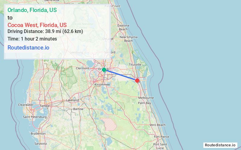
Distance from Orlando, Florida to Cocoa West, Florida
The driving distance from Orlando, Florida to Cocoa West, Florida is 45.6 mi (73.4 km)
The straight-line (air) distance is approximately 24.2 mi (38.9 km)
Estimated travel time by road is 45 minutes
This route includes Toll roads along the way.
We found 2 routes between Orlando and Cocoa West.
Available Routes
Route Directions
Get on FL-408 E
Follow FL-408 E, FL-417 Toll S and FL-528 E to FL-520 E. Take exit 31 from FL-528 E
Follow FL-520 E to your destination in Cocoa West
Route Directions
Get on FL-408 E
Continue on FL-408 E. Take FL-417 Toll S and FL-528 E to FL-520 E/W King St in Brevard County. Take exit 201 from I-95 S
Follow FL-520 E/W King St to your destination in Cocoa West
Journey Details
Traveling from Orlando, Florida to Cocoa West, Florida covers 45.6 miles (73 km) in a east direction. This highway, moderate route typically takes 45 minutes under normal conditions.
Drivers have 2 route options between these locations (46-46 miles / 73-74 km). The primary route shown here saves no time compared to alternatives.
The route features toll sections. During midday weekday travel, expect lighter midday traffic with average speeds around 61 mph (98 km/h) .
Journey Waypoints
Orlando
Starting Point
Cocoa West
Destination
Route Map Image