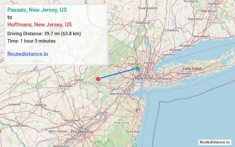
Distance from Passaic, New Jersey to Hoffmans, New Jersey
The driving distance from Passaic, New Jersey to Hoffmans, New Jersey is 54 mi (86.8 km)
The straight-line (air) distance is approximately 24.6 mi (39.7 km)
Estimated travel time by road is 1 hour
This route includes Toll roads along the way.
We found 3 routes between Passaic and Hoffmans.
Available Routes
Route Directions
Get on Garden State Pkwy S in Clifton from Passaic Ave and NJ-3 W
Continue on Garden State Pkwy S. Take I-78 W to Cokesbury Rd in Lebanon. Take exit 20 B from I-78 W
Continue on Cokesbury Rd. Drive to Hoffmans Crossing Rd in Lebanon Township
Route Directions
Get on I-80 W in Wayne from Passaic Ave, NJ-3 W and US-46 W
Continue on I-80 W. Take I-287 S and I-78 W to Cokesbury Rd in Lebanon. Take exit 20 B from I-78 W
Continue on Cokesbury Rd. Drive to Hoffmans Crossing Rd in Lebanon Township
Route Directions
Get on Garden State Pkwy S in Bloomfield from Broadway/Passaic County 622, Bloomfield Ave and W Passaic Ave
Continue on Garden State Pkwy S. Take I-78 W to Cokesbury Rd in Lebanon. Take exit 20 B from I-78 W
Continue on Cokesbury Rd. Drive to Hoffmans Crossing Rd in Lebanon Township
Journey Details
Traveling from Passaic, New Jersey to Hoffmans, New Jersey covers 51.4 miles (83 km) in a west direction. This mixed highways and local roads, moderate route typically takes 1 hour 2 minutes under normal conditions.
Drivers have 3 route options between these locations (51-56 miles / 83-90 km). The primary route shown here saves no time compared to alternatives.
The route features scenic views, toll sections. During morning weekend travel, expect typical weekend traffic patterns with average speeds around 47 mph (76 km/h) .
Journey Waypoints
Passaic
Starting Point
Hoffmans
Destination
Route Map Image