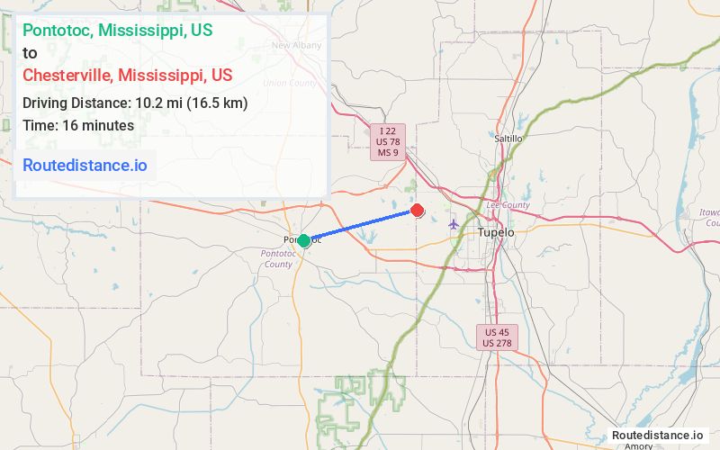
Distance from Pontotoc, Mississippi to Chesterville, Mississippi
The driving distance from Pontotoc, Mississippi to Chesterville, Mississippi is 14.2 mi (22.9 km)
The straight-line (air) distance is approximately 6.4 mi (10.2 km)
Estimated travel time by road is 18 minutes
We found 3 routes between Pontotoc and Chesterville.
Available Routes
Route Directions
Follow S Main St to MS-9 N/Hwy 9 N
Follow MS-9 N. Take the exit toward Endville Rd from MS-9 N
Take Chesterville Rd to Mount Pleasant Rd in Lee County
Route Directions
Take E Marion St to E Oxford St
Continue on E Oxford St. Take Veterans Hwy E, MS-6 E/US-278 E and W Main St to Furrs Rd
Continue on Furrs Rd. Take Sims Gin Rd to Mount Pleasant Rd in Lee County
Route Directions
Take E Marion St to E Oxford St
Continue on E Oxford St. Take Veterans Hwy E to Longview Rd
Continue on Longview Rd. Drive to Mount Pleasant Rd in Lee County
Journey Details
Traveling from Pontotoc, Mississippi to Chesterville, Mississippi covers 13.2 miles (21 km) in a east direction. This mixed highways and local roads, moderate route typically takes 19 minutes under normal conditions.
Drivers have 3 route options between these locations (13-14 miles / 21-23 km). The primary route shown here saves 42 seconds compared to alternatives.
The route features scenic views. During night weekday travel, expect minimal traffic congestion with average speeds around 42 mph (68 km/h) .
Journey Waypoints
Pontotoc
Starting Point
Chesterville
Destination
Route Map Image