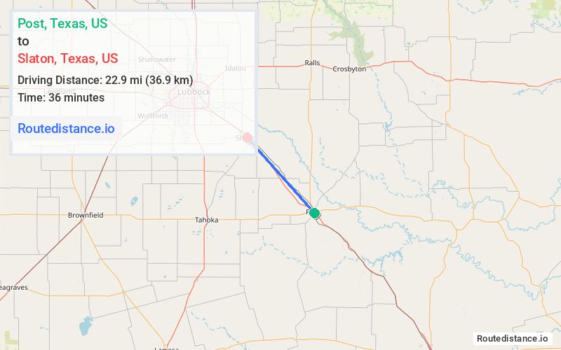
Distance from Post, Texas to Slaton, Texas
The driving distance from Post, Texas to Slaton, Texas is 24 mi (38.6 km)
The straight-line (air) distance is approximately 14.2 mi (22.9 km)
Estimated travel time by road is 23 minutes
We found 2 routes between Post and Slaton.
Available Routes
Route Directions
Follow US-84 W to E County Rd 7800 in Lubbock County. Take the exit toward US-84 BUS/FM 400/Slaton/Wilson from US-84 W
Take E Borden St and S 9th St to your destination
Route Directions
Follow US-84 W to S Hwy 84 Frd Wb/U.s. 84 Frontage Rd in Lubbock County. Take the exit toward US-84 BUS/FM 400/Slaton/Wilson from US-84 W
Take S 9th St to your destination
Journey Details
Traveling from Post, Texas to Slaton, Texas covers 24 miles (39 km) in a northwest direction. This highway, moderate route typically takes 24 minutes under normal conditions.
Drivers have 2 route options between these locations (24-24 miles / 39-39 km). The primary route shown here saves no time compared to alternatives.
Journey Waypoints
Post
Starting Point
Slaton
Destination
Route Map Image