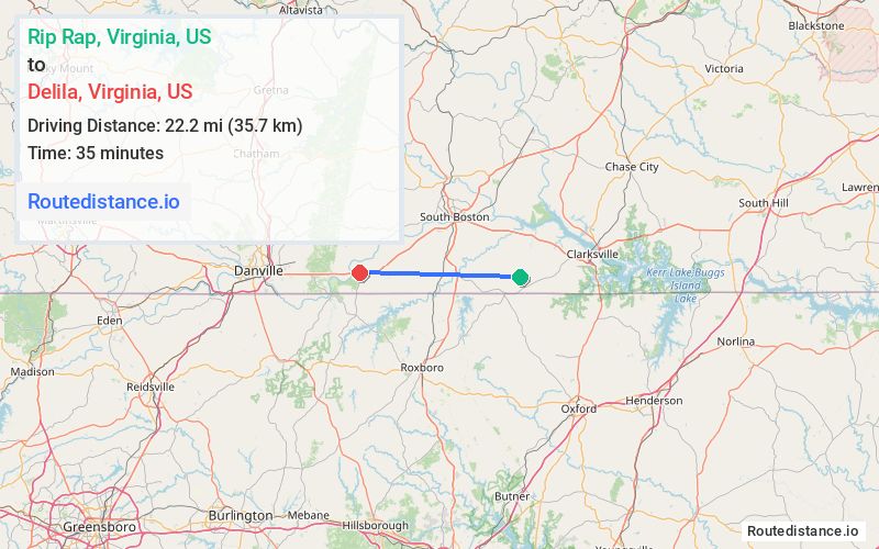
Distance from Rip Rap, Virginia to Delila, Virginia
The driving distance from Rip Rap, Virginia to Delila, Virginia is 29.7 mi (47.9 km)
The straight-line (air) distance is approximately 13.8 mi (22.2 km)
Estimated travel time by road is 36 minutes
We found 3 routes between Rip Rap and Delila.
Available Routes
Route Directions
Route Directions
Follow State Rte 604 and State Rte 734 to Seventh Ave in Virgilina
Take VA-96 W/Virgilina Rd to State Rte 704 in Cluster Springs
Follow State Rte 658 to US-360 W/US-58 W
Follow US-360 W/US-58 W to VA-119 S in Alton
Route Directions
Take State Rte 602, State Rte 741 and State Rte 744 to US-501 N in Riverdale
Follow US-360 W/US-58 W/Philpott Rd to VA-119 S in Alton
Journey Details
Traveling from Rip Rap, Virginia to Delila, Virginia covers 28.8 miles (46 km) in a west direction. This mixed highways and local roads, moderate route typically takes 35 minutes under normal conditions.
Drivers have 3 route options between these locations (29-30 miles / 46-49 km). The primary route shown here saves 2 minutes compared to alternatives.
Journey Waypoints
Rip Rap
Starting Point
Delila
Destination
Route Map Image