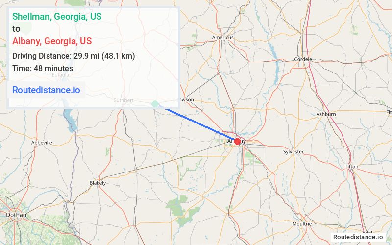
Distance from Shellman, Georgia to Albany, Georgia
The driving distance from Shellman, Georgia to Albany, Georgia is 40.1 mi (64.5 km)
The straight-line (air) distance is approximately 18.6 mi (29.9 km)
Estimated travel time by road is 48 minutes
We found 3 routes between Shellman and Albany.
Available Routes
Route Directions
Take Randolph St to GA-41 S/Calhoun St
Continue on GA-41 S. Take GA-234 E to Pine Ave in Albany
Route Directions
Take Randolph St to Calhoun St/Pearl St
Take US-82 E, Florida Short Route and Gillionville Rd to Pine Ave in Albany
Route Directions
Take Calhoun St/Pearl St to US-82 E
Continue on US-82 E to Albany. Take exit 5 from GA-520 E/US-82 E
Continue on GA-91 S/N Jefferson St. Take N Jackson St to Pine Ave
Journey Details
Traveling from Shellman, Georgia to Albany, Georgia covers 35.7 miles (57 km) in a east direction. This mixed highways and local roads, moderate route typically takes 42 minutes under normal conditions.
Drivers have 3 route options between these locations (36-41 miles / 57-66 km). The primary route shown here saves 10 minutes compared to alternatives.
Journey Waypoints
Shellman
Starting Point
Albany
Destination
Route Map Image