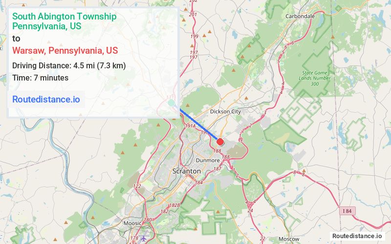
Distance from South Abington Township, Pennsylvania to Warsaw, Pennsylvania
The driving distance from South Abington Township, Pennsylvania to Warsaw, Pennsylvania is 7.9 mi (12.7 km)
The straight-line (air) distance is approximately 2.8 mi (4.6 km)
Estimated travel time by road is 13 minutes
We found 3 routes between South Abington Township and Warsaw.
Available Routes
Route Directions
Take Willowbrook Rd, Edella Rd and PA-407 S to US-11 S/US-6 E
Continue on US-11 S. Take I-81 S/US-6 E to PA-347 N/North Blakely Street in Dunmore. Take exit 188 from I-81 S/US-6 E
Follow PA-347 N to Line St in Throop
Route Directions
Get on I-476 S/US-6 E
Take I-81 S to N Main Ave in Scranton. Take exit 190 from I-81 S
Continue on N Main Ave. Take E Parker St and Olyphant Ave to Line St in Throop
Route Directions
Get on I-476 S/US-6 E
Take I-81 S to PA-347 N/North Blakely Street in Dunmore. Take exit 188 from I-81 S
Follow PA-347 N to Line St in Throop
Journey Details
Traveling from South Abington Township, Pennsylvania to Warsaw, Pennsylvania covers 7.2 miles (12 km) in a southeast direction. This secondary roads, short route typically takes 11 minutes under normal conditions.
Drivers have 3 route options between these locations (7-8 miles / 12-13 km). The primary route shown here saves 5 minutes compared to alternatives.
Journey Waypoints
South Abington Township
Starting Point
Warsaw
Destination
Route Map Image