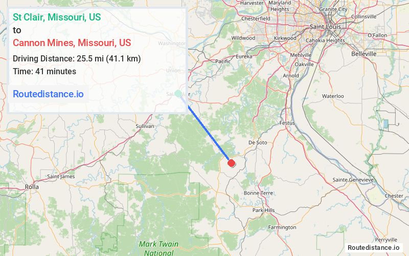
Distance from St Clair, Missouri to Cannon Mines, Missouri
The driving distance from St Clair, Missouri to Cannon Mines, Missouri is 33.2 mi (53.4 km)
The straight-line (air) distance is approximately 15.9 mi (25.5 km)
Estimated travel time by road is 44 minutes
We found 3 routes between St Clair and Cannon Mines.
Available Routes
Route Directions
Take W Gravois Ave to Hwy K in Parkway
Follow Hwy K and Yellow Dog Rd to State Hwy 47 S in Prairie Township
Continue on State Hwy 47 S to Kingston Township
Take Cannon Mines Rd to Clover Rd in Union Township
Route Directions
Follow State Hwy 47 S to State Rd H in Richwoods Township
Continue on State Rd H to Valle Township
Take Cannon Mines Rd to Clover Rd in Union Township
Route Directions
Take State Hwy 47 S to State Hwy CC in Kingston Township
Take Cannon Mines Rd to Clover Rd in Union Township
Journey Details
Traveling from St Clair, Missouri to Cannon Mines, Missouri covers 32.3 miles (52 km) in a southeast direction. This mixed highways and local roads, moderate route typically takes 39 minutes under normal conditions.
Drivers have 3 route options between these locations (32-40 miles / 52-64 km). The primary route shown here saves 10 minutes compared to alternatives.
Journey Waypoints
St Clair
Starting Point
Cannon Mines
Destination
Route Map Image