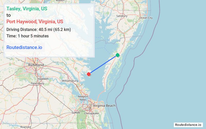
Distance from Tasley, Virginia to Port Haywood, Virginia
The driving distance from Tasley, Virginia to Port Haywood, Virginia is 136.4 mi (219.6 km)
The straight-line (air) distance is approximately 25.2 mi (40.5 km)
Estimated travel time by road is 2 hours 43 minutes
This route includes Toll roads along the way.
We found 3 routes between Tasley and Port Haywood.
Available Routes
Route Directions
Take US-13 BUS S to US-13 S
Continue on US-13 S. Take I-64 W and US-17 N to VA-14 E/VA-3 W in Gloucester
Drive to VA-14 E in Port Haywood
Route Directions
Follow US-13 BUS S to US-13 S in Onley
Follow US-13 S and I-64 W to VA-30 W in James City County. Take exit 227 from I-64 W
Take VA-273 N, VA-33 E and VA-198 E to VA-14 E in Port Haywood
Route Directions
Follow US-13 BUS S to US-13 S in Onley
Follow US-13 S, I-64 W and US-17 N to VA-14 E/VA-3 W in Gloucester
Drive to VA-14 E in Port Haywood
Journey Details
Traveling from Tasley, Virginia to Port Haywood, Virginia covers 135.9 miles (219 km) in a southwest direction. This mixed highways and local roads, substantial route typically takes 2 hours 40 minutes under normal conditions.
Drivers have 3 route options between these locations (136-170 miles / 219-274 km). The primary route shown here saves 27 minutes compared to alternatives.
The route features scenic views, toll sections. During morning weekday travel, expect morning rush hour with average speeds around 51 mph (82 km/h) .
Journey Waypoints
Tasley
Starting Point
Port Haywood
Destination
Route Map Image