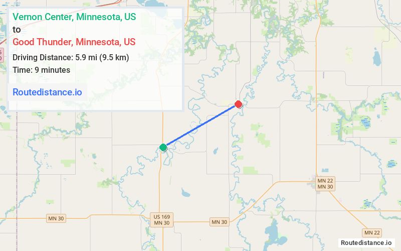
Distance from Vernon Center, Minnesota to Good Thunder, Minnesota
The driving distance from Vernon Center, Minnesota to Good Thunder, Minnesota is 10.1 mi (16.3 km)
The straight-line (air) distance is approximately 3.7 mi (5.9 km)
Estimated travel time by road is 11 minutes
We found 3 routes between Vernon Center and Good Thunder.
Available Routes
Route Directions
Continue on 164th St. Take Goose Rd to Main St in Good Thunder
Route Directions
Continue on 134th St to 550th Ave
Continue on 550th Ave. Drive to Main St in Good Thunder
Route Directions
Take 139th St, 542nd Ave and 153rd St to Main St in Good Thunder
Journey Details
Traveling from Vernon Center, Minnesota to Good Thunder, Minnesota covers 8.8 miles (14 km) in a east direction. This mixed highways and local roads, short route typically takes 11 minutes under normal conditions.
Drivers have 3 route options between these locations (9-12 miles / 14-19 km). The primary route shown here saves 4 minutes compared to alternatives.
Journey Waypoints
Vernon Center
Starting Point
Good Thunder
Destination
Route Map Image