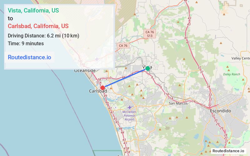
Distance from Vista, California to Carlsbad, California
The driving distance from Vista, California to Carlsbad, California is 8.4 mi (13.6 km)
The straight-line (air) distance is approximately 3.9 mi (6.2 km)
Estimated travel time by road is 13 minutes
We found 3 routes between Vista and Carlsbad.
Available Routes
Route Directions
Get on CA-78 W/Ronald Packard Pkwy from S Santa Fe Ave and Lado De Loma Dr
Continue on CA-78 W/Ronald Packard Pkwy to Carlsbad. Take exit 50 from I-5 S
Continue on Carlsbad Village Dr. Drive to Pio Pico Dr
Route Directions
Follow S Santa Fe Ave to Guajome St
Take Lado De Loma Dr to Vista Village Dr
Follow CA-78 W, College Blvd and Carlsbad Village Dr to Pio Pico Dr in Carlsbad
Route Directions
Get on CA-78 W from S Santa Fe Ave and Lado De Loma Dr
Follow CA-78 W to S El Camino Real in Oceanside. Take exit 2 from CA-78 W
Follow S El Camino Real and Carlsbad Village Dr to Pio Pico Dr in Carlsbad
Journey Details
Traveling from Vista, California to Carlsbad, California covers 7.8 miles (12 km) in a west direction. This secondary roads, short route typically takes 13 minutes under normal conditions.
Drivers have 3 route options between these locations (8-8 miles / 12-14 km). The primary route shown here saves 4 minutes compared to alternatives.
The route features scenic views. During midday weekday travel, expect lighter midday traffic with average speeds around 35 mph (56 km/h) .
Journey Waypoints
Vista
Starting Point
Carlsbad
Destination
Route Map Image