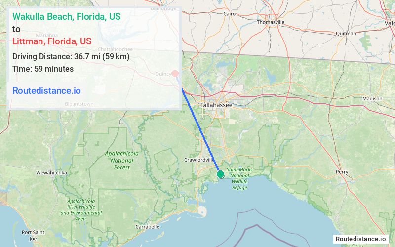
Distance from Wakulla Beach, Florida to Littman, Florida
The driving distance from Wakulla Beach, Florida to Littman, Florida is 46.6 mi (75 km)
The straight-line (air) distance is approximately 22.8 mi (36.7 km)
Estimated travel time by road is 1 hour 9 minutes
We found 3 routes between Wakulla Beach and Littman.
Available Routes
Route Directions
Drive from FL-363 N to Leon County
Continue on FL-263 N/Capital Cir SW. Take Shady Rest Rd to FL-12 W in Gadsden County
Route Directions
Continue on US-98 E. Take FL-363 N, N Monroe St, I-10 W, US-90 W and Lanier Rd to FL-12 W in Gadsden County
Route Directions
Drive from FL-363 N to Leon County
Take US-90 W to FL-12 W in Gadsden County
Journey Details
Traveling from Wakulla Beach, Florida to Littman, Florida covers 46.4 miles (75 km) in a northwest direction. This secondary roads, moderate route typically takes 1 hour 7 minutes under normal conditions.
Drivers have 3 route options between these locations (46-48 miles / 75-77 km). The primary route shown here saves 4 minutes compared to alternatives.
The route features scenic views, coastal roads. During midday weekday travel, expect lighter midday traffic with average speeds around 39 mph (63 km/h) .
Journey Waypoints
Wakulla Beach
Starting Point
Littman
Destination
Route Map Image