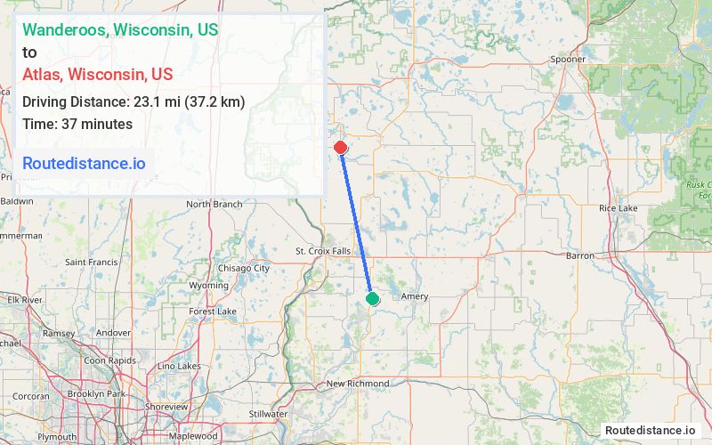
Distance from Wanderoos, Wisconsin to Atlas, Wisconsin
The driving distance from Wanderoos, Wisconsin to Atlas, Wisconsin is 29.9 mi (48.2 km)
The straight-line (air) distance is approximately 14.4 mi (23.1 km)
Estimated travel time by road is 37 minutes
We found 3 routes between Wanderoos and Atlas.
Available Routes
Route Directions
Take 70th Ave to WI-65 N
Continue on 160th St to Balsam Lake
Continue on WI-46 N to Luck
Follow 270th Ave, 275th Ave and 210th St to 295th Ave in Laketown
Route Directions
Take 70th Ave to WI-65 N
Continue on WI-65 N. Take US-8 W to S Rd/160th Ave in St. Croix Falls
Route Directions
Take 70th Ave to WI-65 N
Continue on WI-65 N. Take 100th Ave and 190th St to 200th St in St. Croix Falls
Journey Details
Traveling from Wanderoos, Wisconsin to Atlas, Wisconsin covers 29 miles (47 km) in a north direction. This mixed highways and local roads, moderate route typically takes 39 minutes under normal conditions.
Drivers have 3 route options between these locations (29-36 miles / 47-57 km). The primary route shown here saves 2 minutes compared to alternatives.
The route features scenic views. During night weekday travel, expect minimal traffic congestion with average speeds around 44 mph (71 km/h) .
Journey Waypoints
Wanderoos
Starting Point
Atlas
Destination
Route Map Image