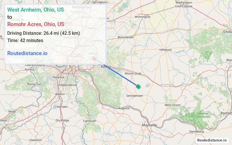
Distance from West Arnheim, Ohio to Romohr Acres, Ohio
The driving distance from West Arnheim, Ohio to Romohr Acres, Ohio is 35.7 mi (57.5 km)
The straight-line (air) distance is approximately 16.4 mi (26.4 km)
Estimated travel time by road is 53 minutes
We found 2 routes between West Arnheim and Romohr Acres.
Available Routes
Route Directions
Take White Oak Valley Rd to OH-774 W in Clark Township
Continue on OH-125 W. Take OH-222 N and State Rte 32 W to Berdale Ln in Union Township
Route Directions
Take Hamer Rd, Goose Run Rd and New Hope-White Oak Station Rd to State Rte 32 W in Green Township
Follow Beechwood Rd to Berdale Ln
Journey Details
Traveling from West Arnheim, Ohio to Romohr Acres, Ohio covers 35 miles (56 km) in a northwest direction. This mixed highways and local roads, moderate route typically takes 42 minutes under normal conditions.
Drivers have 2 route options between these locations (35-36 miles / 56-57 km). The primary route shown here saves 11 minutes compared to alternatives.
The route features scenic views. During night weekday travel, expect minimal traffic congestion with average speeds around 50 mph (80 km/h) .
Journey Waypoints
West Arnheim
Starting Point
Romohr Acres
Destination
Route Map Image