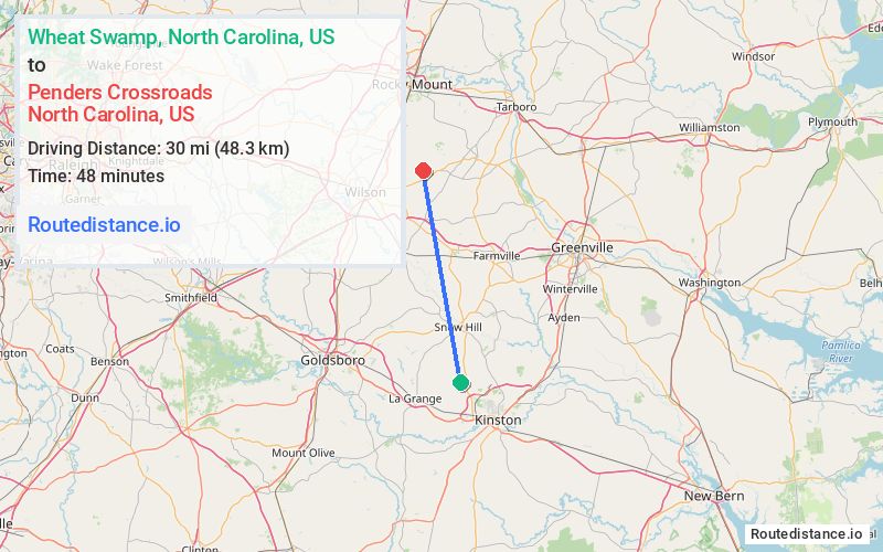
Distance from Wheat Swamp, North Carolina to Penders Crossroads, North Carolina
The driving distance from Wheat Swamp, North Carolina to Penders Crossroads, North Carolina is 35.3 mi (56.8 km)
The straight-line (air) distance is approximately 18.7 mi (30 km)
Estimated travel time by road is 41 minutes
We found 3 routes between Wheat Swamp and Penders Crossroads.
Available Routes
Route Directions
Take NC-58 N to N Rogers St in Saratoga
Follow Gardners School Rd to NC-42 E
Take Town Creek Rd to Bridgersville Rd
Route Directions
Take NC-58 N to Weaver Rd in Wilson County
Follow Town Creek Rd to Bridgersville Rd
Route Directions
Continue on US-258 N. Take NC-91 N to N Rogers St in Saratoga
Follow Gardners School Rd to NC-42 E
Take Town Creek Rd to Bridgersville Rd
Journey Details
Traveling from Wheat Swamp, North Carolina to Penders Crossroads, North Carolina covers 34.5 miles (55 km) in a north direction. This mixed highways and local roads, moderate route typically takes 43 minutes under normal conditions.
Drivers have 3 route options between these locations (34-40 miles / 55-65 km). The primary route shown here saves 5 minutes compared to alternatives.
The route features scenic views. During evening weekday travel, expect evening rush hour with average speeds around 51 mph (82 km/h) .
Journey Waypoints
Wheat Swamp
Starting Point
Penders Crossroads
Destination
Route Map Image