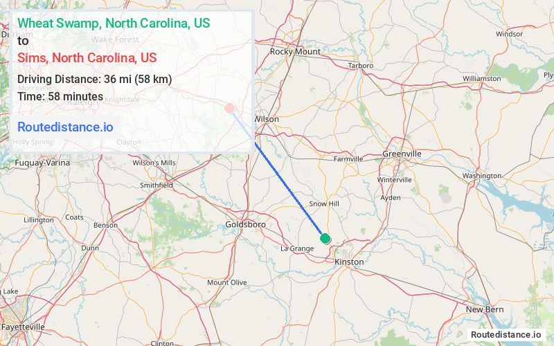
Distance from Wheat Swamp, North Carolina to Sims, North Carolina
The driving distance from Wheat Swamp, North Carolina to Sims, North Carolina is 41.8 mi (67.3 km)
The straight-line (air) distance is approximately 22.4 mi (36.1 km)
Estimated travel time by road is 44 minutes
We found 3 routes between Wheat Swamp and Sims.
Available Routes
Route Directions
Take Hull Rd to US-13 S in Snow Hill
Get on I-587/US-264 W in Wilson County
Continue on I-587/US-264 W. Take I-795 N to US-264 ALT W. Take exit 36 A from US-264 W
Route Directions
Get on I-42 W in Wayne County from Hugh E Hardy Rd, Pauls Path Rd, Jason Rd and Parkstown Rd
Follow I-42 W and I-795 N to US-264 ALT W in Wilson County. Take exit 36 A from US-264 W
Route Directions
Take Hull Rd to US-13 S in Snow Hill
Continue on NC-58 N. Take Raleigh Rd Pkwy W to US-264 ALT W in Sims
Journey Details
Traveling from Wheat Swamp, North Carolina to Sims, North Carolina covers 41 miles (66 km) in a northwest direction. This mixed highways and local roads, moderate route typically takes 53 minutes under normal conditions.
Drivers have 3 route options between these locations (41-47 miles / 66-76 km). The primary route shown here saves no time compared to alternatives.
Journey Waypoints
Wheat Swamp
Starting Point
Sims
Destination
Route Map Image