Distance to Alma, Arkansas

Calculating Your Route
Just a moment while we process your request...
Location Information
-
Full AddressAlma, AR 72921
-
Coordinates35.4922086, -94.2260868
-
LocationAlma , Arkansas , US
-
TimezoneAmerica/Chicago
-
Current Local Time7:41:34 PM America/ChicagoTuesday, June 17, 2025
-
Page Views0
About Alma
Alma is a city in Crawford County, in far western Arkansas, United States. It is located within the Arkansas River Valley at the edge of the Ozark Mountains; the city is the sixth largest in the Fort Smith metropolitan area. The population was 5,419 at the 2010 Census.


Nearby Places
Found 10 places within 50 miles

Van Buren
7.7 mi
12.4 km
Van Buren, AR 72956
Get directions

Fort Smith
13.3 mi
21.4 km
Fort Smith, AR
Get directions

Greenwood
19.4 mi
31.2 km
Greenwood, AR 72936
Get directions

Sallisaw
31.7 mi
51.0 km
Sallisaw, OK 74955
Get directions

Prairie Grove
33.8 mi
54.4 km
Prairie Grove, AR
Get directions

Poteau
37.7 mi
60.7 km
Poteau, OK
Get directions

Farmington
37.8 mi
60.8 km
Farmington, AR 72730
Get directions

Fayetteville
39.5 mi
63.6 km
Fayetteville, AR
Get directions

Clarksville
42.6 mi
68.6 km
Clarksville, AR 72830
Get directions

Springdale
47.4 mi
76.3 km
Springdale, AR
Get directions
Location Links
Local Weather
Weather Information
Coming soon!
Location Map
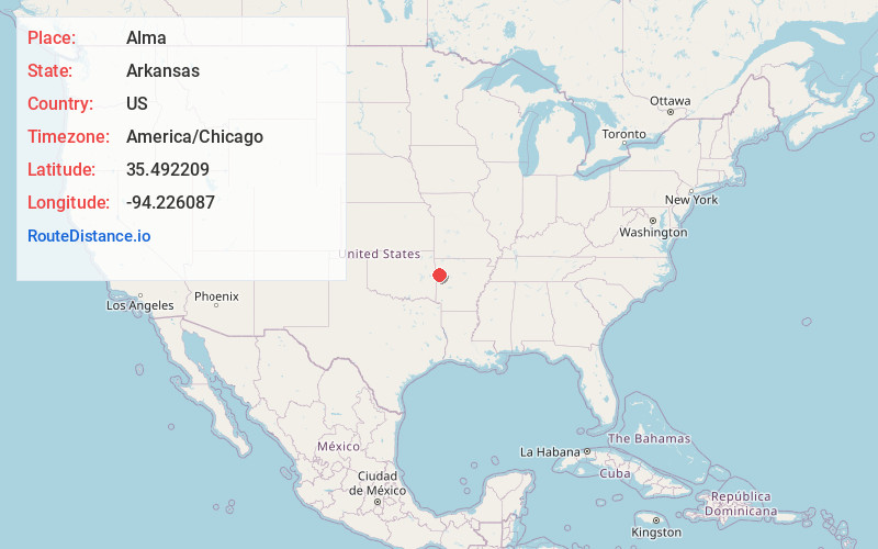
Static map view of Alma, Arkansas
Browse Places by Distance
Places within specific distances from Alma
Short Distances
Long Distances
Click any distance to see all places within that range from Alma. Distances shown in miles (1 mile ≈ 1.61 kilometers).