Distance to Bloomfield, New Jersey

Calculating Your Route
Just a moment while we process your request...
Location Information
-
Full AddressBloomfield, NJ
-
Coordinates40.8107831, -74.1863737
-
LocationBloomfield , New Jersey , US
-
TimezoneAmerica/New_York
-
Current Local Time5:17:23 AM America/New_YorkWednesday, June 18, 2025
-
Website
-
Page Views0
About Bloomfield
Bloomfield is a township in Essex County, in the U.S. state of New Jersey, and an inner-ring suburb of Newark.


Nearby Places
Found 10 places within 50 miles

East Orange
3.7 mi
6.0 km
East Orange, NJ
Get directions

West Orange
4.0 mi
6.4 km
West Orange, NJ 07052
Get directions

Clifton
4.0 mi
6.4 km
Clifton, NJ
Get directions

Passaic
4.4 mi
7.1 km
Passaic, NJ
Get directions

Newark
5.5 mi
8.9 km
Newark, NJ
Get directions

Irvington
6.2 mi
10.0 km
Irvington, NJ 07111
Get directions

Paterson
7.5 mi
12.1 km
Paterson, NJ
Get directions

North Bergen
8.2 mi
13.2 km
North Bergen, NJ
Get directions

Union City
8.5 mi
13.7 km
Union City, NJ
Get directions

West New York
9.0 mi
14.5 km
West New York, NJ 07093
Get directions
Location Links
Local Weather
Weather Information
Coming soon!
Location Map
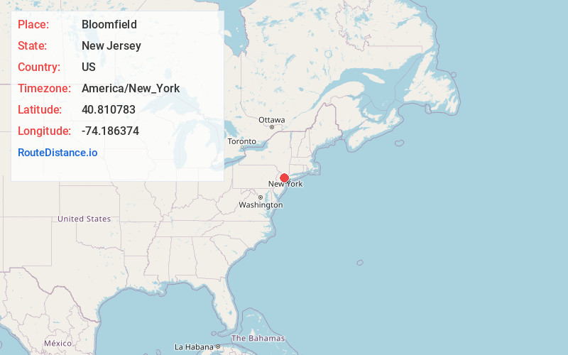
Static map view of Bloomfield, New Jersey
Browse Places by Distance
Places within specific distances from Bloomfield
Short Distances
Long Distances
Click any distance to see all places within that range from Bloomfield. Distances shown in miles (1 mile ≈ 1.61 kilometers).