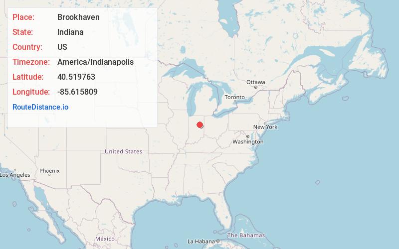
Distance to Brookhaven, Indiana

Calculating Your Route
Just a moment while we process your request...
Location Information
-
Full AddressBrookhaven, Center Township, IN 46953
-
Coordinates40.5197627, -85.6158092
-
LocationCenter Township , Indiana , US
-
TimezoneAmerica/Indianapolis
-
Page Views0
Nearby Places
Found 10 places within 50 miles

Gas City
2.3 mi
3.7 km
Gas City, IN
Get directions

Jonesboro
2.8 mi
4.5 km
Jonesboro, IN
Get directions

Kiley
3.4 mi
5.5 km
Kiley, Franklin Township, IN 46953
Get directions

Marion
3.5 mi
5.6 km
Marion, IN
Get directions
Michaelsville
4.5 mi
7.2 km
Michaelsville, IN 46953
Get directions
Shady Hills
5.7 mi
9.2 km
Shady Hills, Center Township, IN 46952
Get directions
Roseburg
6.0 mi
9.7 km
Roseburg, IN 46953
Get directions
Landess
6.9 mi
11.1 km
Landess, IN
Get directions
Weaver
7.0 mi
11.3 km
Weaver, Liberty Township, IN 46953
Get directions

Upland
7.1 mi
11.4 km
Upland, IN 46989
Get directions
Location Links
Local Weather
Weather Information
Coming soon!
Location Map
Static map view of Brookhaven, Indiana
Browse Places by Distance
Places within specific distances from Brookhaven
Short Distances
Long Distances
Click any distance to see all places within that range from Brookhaven. Distances shown in miles (1 mile ≈ 1.61 kilometers).