Distance to Browns, Ohio

Calculating Your Route
Just a moment while we process your request...
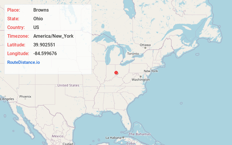
Location Information
-
Full AddressBrowns, Monroe Township, OH 45382
-
Coordinates39.9025507, -84.5996757
-
LocationMonroe Township , Ohio , US
-
TimezoneAmerica/New_York
-
Current Local Time3:42:42 PM America/New_YorkSaturday, June 14, 2025
-
Page Views0
About Browns
Browns is an unincorporated community in Preble County, in the U.S. state of Ohio.
Nearby Places
Found 10 places within 50 miles

West Manchester
1.4 mi
2.3 km
West Manchester, OH 45382
Get directions
Castine
2.4 mi
3.9 km
Castine, OH 45304
Get directions
Ithaca
3.4 mi
5.5 km
Ithaca, OH 45304
Get directions
Eldorado
4.0 mi
6.4 km
Eldorado, OH 45321
Get directions
Hamburg
4.2 mi
6.8 km
Hamburg, OH 45347
Get directions

Lewisburg
5.0 mi
8.0 km
Lewisburg, OH 45338
Get directions
Gordon
5.2 mi
8.4 km
Gordon, OH 45304
Get directions
Verona
6.1 mi
9.8 km
Verona, OH
Get directions
Beechgrove
6.1 mi
9.8 km
Beechgrove, Butler Township, OH 45304
Get directions

Arcanum
6.5 mi
10.5 km
Arcanum, OH 45304
Get directions
Location Links
Local Weather
Weather Information
Coming soon!
Location Map
Static map view of Browns, Ohio
Browse Places by Distance
Places within specific distances from Browns
Short Distances
Long Distances
Click any distance to see all places within that range from Browns. Distances shown in miles (1 mile ≈ 1.61 kilometers).