Distance to Calabasas, California

Calculating Your Route
Just a moment while we process your request...
Location Information
-
Full AddressCalabasas, CA
-
Coordinates34.1539731, -118.6473801
-
LocationCalabasas , California , US
-
TimezoneAmerica/Los_Angeles
-
Current Local Time5:05:33 PM America/Los_AngelesSaturday, June 21, 2025
-
Website
-
Page Views0
About Calabasas
Calabasas is a city in the southwestern region of the San Fernando Valley in Los Angeles County, California, United States. Situated between the foothills of the Santa Monica and Santa Susana mountains, 29.9 miles northwest of downtown Los Angeles, Calabasas has a population of 22,491.


Nearby Places
Found 10 places within 50 miles

Simi Valley
11.1 mi
17.9 km
Simi Valley, CA
Get directions

Thousand Oaks
11.6 mi
18.7 km
Thousand Oaks, CA
Get directions

Santa Monica
13.3 mi
21.4 km
Santa Monica, CA
Get directions

Beverly Hills
15.1 mi
24.3 km
Beverly Hills, CA
Get directions

Moorpark
16.2 mi
26.1 km
Moorpark, CA 93021
Get directions

Culver City
17.0 mi
27.4 km
Culver City, CA
Get directions

Santa Clarita
17.5 mi
28.2 km
Santa Clarita, CA
Get directions

Burbank
19.5 mi
31.4 km
Burbank, CA
Get directions

Inglewood
21.3 mi
34.3 km
Inglewood, CA
Get directions

Camarillo
22.7 mi
36.5 km
Camarillo, CA
Get directions
Location Links
Local Weather
Weather Information
Coming soon!
Location Map
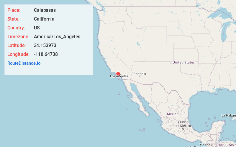
Static map view of Calabasas, California
Browse Places by Distance
Places within specific distances from Calabasas
Short Distances
Long Distances
Click any distance to see all places within that range from Calabasas. Distances shown in miles (1 mile ≈ 1.61 kilometers).